The Sultanat of Oman.
20 days traveling through stunning mountains, beautiful deserts and beaches, for a magical ride in a geological and cultural wonderland.
Welcome to our extensive Travel Guide / Road Book dedicated to the Sultanate of Oman, where in the span of 20 days you will complete the ultimate trail all around one of the jewels of Arabia. Oman is a very trending tourist destination these days, but no-one will show it to you the way we are. Our trail will not only take you to major natural and cultural landmarks, it will make it a once in a lifetime adventure. Because what matters to us, is the journey. Forget the main crowded destinations, this blog is all about unique places and less traveled back trails.

A 20 days, 4.000 kms or so loop around Oman.
Available for you is the Google Earth .KMZ file you’ll need to open in Google Earth to visualise the trail, and then transfer as a GPX file on the gps device of your choice.
To open it, go to GOOGLE EARTH, click on FILE, then OPEN, go to DOWNLOADS, and select OT.kmz
Please click on the link below to download the trail.
The Oman Trail
Table of contents
- Introduction
- Basic informations
- Ways to travel
- Muscat
- The route
- Day One – From Muscat to Dibab
- Day Two – From Dibab to Fins
- Day Three – Treking Wadii Shab & Tiwi
- Day Four – From Fins to the Wahibah sands
- Day Five – The Wahibah sands crossing
- Day Six – Around Baar Al Hikman
- Day Seven – The Al Huqf range
- Day Eight – From Ra’s Madraka to Wadi Shuwaymiyah
- Day Nine – Al Dhofar Mountains
- Day Ten – Salalah
- Day Eleven – From Salalah to Tawsinat
- Day Twelve – Crossing Ar Rub Al Khali – part One
- Day Thirteen – Crossing Ar Rub Al Khali – part Two
- Day Fourteen – Crossing Ar Rub Al Khali – part Three
- Day Fifteen – Crossing the Alluvial fan to Yanqul
- Day Sixteen – From Yanqul to Bat
- Day Seventeen – From Bat to Jabal Shams
- Day Eighteen – From Jabal Shams to Jabal Akhdar
- Day Nineteen – Back to Muscat
- Conclusion
INTRODUCTION
The Sultanate of Oman. The name alone resonates like an exotic adventure… We first think of Sindbad the sailor and his fellow pirates finding refuge in the many isolated creeks of the coast, tracked down by european warships… The bedu’s caravans traveling through the furnace of the desert on their way to some remote oasis… Or the rugged mountaineers in isolated settlements, cherishing date gardens in a land where water is a rare treasure.
However, what most of us will often miss about Oman, are the marvelous stories the sand of the arid deserts and the exposed rocks of the bare mountains, reveal about our planet’s tumultuous history. Indeed, Oman isn’t just a cultural experience, it is first and foremost a geological paradise. An open book through our past for the curious mind.
Trying to combine all those aspects, we have traced a 20 days, 4.000 kms or so journey. Across Al Hajar mountains, Al Wahibah sands, Al Huqf range, Al Qara mountains of Dhufar and the amazing sand dunes of Ar Rub Al Khali, we will be confronted with a wide spectrum of physical and technical challenges. As we pass through those beautiful and remote natural landscapes, we will learn how it geologically came about, discover their rich local history, and interact with an incredibly hospitable population. Jebal, wadii, forts, aflaj, ruins of old settlements, ancestral date gardens, beehive tombs, mosques, souks, and so much more, await us as we go deeper within a country entrenched in its traditions and ancestral ways…
The following Guide/Road-book tries to combine all the informations you need to venture safely and learn as much as you can about this enchanted land. A GPS ready version will be shortly available for download. Make sure to come back and check it out.
The geological wonders of Oman
Like most of the geologically untrained people coming to Oman, I first ventured out not knowing anything about the significance of what I was witnessing. Yet a simple look at these landscapes immediately called for so many questions. How, when, why this, why that ? I knew right away I was missing out on a lot of great stuff. Curious as I am, I embarked on an overwhelming research on internet, reading way too complex and often conflicting scientific reviews on geology and earth’s evolution, trying to come up with simple answers. During three full weeks I was immersed in my dictionary searching for every name and scientific terms they threw at me. But the more I learned, the more questions I had, and however fascinating it became, I was forced to admit that there was no such thing as a simple answer, or a easy way to explain it to you with words.
Instead, I found and would like to share with you this great video done By Oman Geological Society, which with wimple words, cool animations and beautiful images, illustrates perfectly how wonderful what you are about to see for yourselves on this journey is.
If like me you are eager to know more, I invite you to take the time to investigate further on your own.
A history of Oman.
Pre-Historical times.
Oman first history, as we know it, goes all the way back to 135,000 years ago, when the first climate migrants (already!), escaped the prolonged droughts of the African plains they lived on. At the time, the Arabian peninsula was far more hospitable than it is now, and offered better surviving conditions. Crossing a much narrower and shallower Red Sea, the early settlers moved on, some finding relief in what are today Yemen, the Sultanate of Oman and the UAE. Stone tools dated from 125,000 years ago have been found in the area attesting of their presence.
As shown by other recent archeological discoveries, men flourished in this land. Throughout what we like to call the Stone, Bronze and Iron ages, all the way to the arrival of the first muslim fighters, the area was linked to a complex and sophisticated regional trading network, recognized as a well established outpost within the antique civilizations of the Middle-East, one that never stopped to grow.
During that time, tribes erected sophisticated architectural structures made of local stones and mud, some as early as 5.500 years ago. Complex Necropolis sites from that era, like the beehive tombs of Al Ayn, are still visible today. In the Hilli site in the UAE, we have found weapons and jeweleries, as well as potteries from Southern Mesopotamia, confirming the prosperous regional trade activities. Their ability to survive an environment turning more arid with the help of complex irrigation systems, allowed them to settle and prosper, feeding on livestocks or crops like cereals and dates. Rich in natural resources, such as copper, the region, know as “Magan” in ancient Mesopotamian writings, (which could mean the copper mountain), exported some early on as far as the Indus river valley, also confirming their nautical abilities.
With time, the Persian population was replaced by Arab tribes coming from Yemen. And as the population grew, the early settlements turned into fortified towns and ports, looking over fishermen, farmers and merchants.
Islamic times.
The next major cultural shift within the population came with the arrival of the first Muslim fighters in 630 AD led by Amr ibn al’As. The local Arab ruling family, the Julanda, welcomed the general and his army hoping it would freed them from Persian domination. In 632, thanks to reinforcements send from Medina by Khalifa Abu Bakr, the muslims finally turned victorious at the battle of Dibba, opening the way for the spread of Islam through Oman. As much as local arabs were quick to embrace the new religion, it didn’t take long for them to branch out with their own version of the prophet’s preachings, called Ibadhism, making it one of the earliest branch of Islam.
Ibadhism’s intent is to remain true to the original preachings, before it was “corrupted” by the third Khalifa Uthman. Concentrated mostly in Oman, where about 75% of the local population still consider itself Ibadhi, the school has been very prolific in regards to islamic law. Under Ibadhi law, local Sheikhs decided to elect their rulers by communal consensus, as opposed to hereditary rules as custom in other muslim teachings of the time. In order to be Imam in Oman, you had to be first nominated by the Ulema (the guardians of the religious doctrine), then receive allegiance from all local Sheikhs, as well as the local population. Due to its isolation, as well as its peaceful ways, this system survived all the way to the middle of the 20th century.
Opening to the sea.
As every land opened to the sea, Oman made the most of its geographical position. Very early on, as soon as it could safely venture off-shore, local merchants went on to explore new trade opportunities. First concentrating on direct neighboring countries, it then expended to India, Eastern Africa, and as far as China, bringing riches to local merchants.
With the arrival of the Europeans, Oman became a trading stop on the road to Asia. Here, goods from all over were exchanged, providing great revenues to locals. Combining their own navigating skills with those learned from foreigners, by the late XVII century the Omanis were a naval force to be reckoned with, expending their own territories to part of East Africa, all the way down to Zanzibar, making it for a while their own capital.
By then, they were not alone making their presence felt on the sea. On the other side of Hormuz, the tribes of Sharjah, Umm al Quwain, and Ras al Khaimah, known as the Qawasim pirates, ransomed merchant ships trading around the area. Their presence became such a menace to the business equilibrium of the area, it had to be put to an end by the British Navy, taking over the control of the region in the process.
Foreign influences.
The British take over in 1820, is the last of a long list of foreign powers controlling this strategic geographical position.
Looking over the straight of Hormuz, not to mention its rich natural resources, Oman has always been the prey of numerous foreign powers. From the beginning of time the Persians have had a strong hold on the region. As mentioned above, other Arab tribes came in from Yemen and Medina. In the middle of the tenth century, the Qarmatians Tribes from Eastern Arabia, a little north of present day Qatar, seized control, shortly followed by the Iranian Buyyids dynasty from 967 to 1053, themselves replaced by the Turco-Iaranian Seljuk Empire from 1053 to 1154.
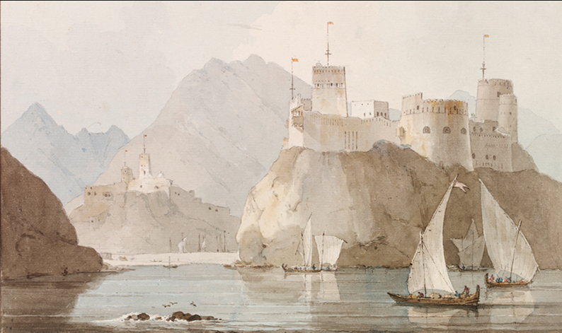
Having managed to regain their own destiny in 1154 under the rule of the Nabahni Kings, Oman fell again, this time to European influence, with the arrival of the Portuguese in 1508. They stayed on till 1650, leaving behind the many forts along the coast you see today. Shortly after, Persians will get involved again for a little while, before a second golden age of Omani independence from 1744 till 1820, interrupted again by the British domination.
The great dynasties of Oman.
Ya’ruba dynasty.
In 1648, Iman Sultan ibn Saif, defeated the Portuguese in Muscat, before chasing them all the way to India, taking over most of their colonies in the process. At the time, Nizwa is the capital of the Imamate of Oman. Status reinforced by the erection of a new fortress still visible today. Saif Ibn Sultan, his son, will continue the work of his father, stripping the Portuguese of even more colonies, particularly on the Eastern African coast. The liberation and the following unification of the country, the military conquests, the strength of the Oman navy, have allowed the Imams to negotiate as equals with the other European actors in the region. The new trade agreements are no longer imposed on Oman by force, as the Portuguese had done. Instead the British are now invited to the business table as equals. All of which did bring almost a century of peace and wealth to the nation.
Unfortunately, after the death of Sultan ibn Saif in 1718, the Ya’ruba dynasty and the rest of the country did fall into a succession war the Persian ultimately took advantage of, until the rise of Ahmed ibn Said in 1747.
The Al Bu Said dynasty.
The Said dynasty starts with the rise of Ahmed ibn Said who, after expelling the Persians managed to reunite the country again. Despite constant attacks from outside powers, on land or at sea, the Saids kept control over the trade transiting through the straight of Hormuz, and imposed their conditions on all local exchanges. During the reign of Sayyid Said ibn Sultan (1804-1856) Oman expanded so much it actually moved its government to Zanzibar, making it its new official capital. However his death announced the end of a golden age, with two of his sons involved in a new succession dispute. Oman is divided and split between the two. One son taking control of the Sultanate, the other Zanzibar. Not all will be easy from then on for Oman. The Al Bu Said clan, now a royal dynasty suffered the same internecine power struggles, murders and treasons common in all ruling parties. But despite all the in fighting, notably between the Imams of Nizwa and the Sultans from Muscat, the Said family has managed to keep the reins of Oman’s destiny, Sultan Qaboos being the last of them ruling the country today.
Imams and Sultans.
One of the many problems Oman had to overcome was the constant battle for power between the elected Imams residing in Nizwa and controlling the mountains, and the hereditary Sultans rulling Muscat and the coast. The Said dynasty, in an attempt to unify the country had ceased to recognized the Imam of the interior. While the interior tribes refused to consider anyone else than the elected Imam as their legitimate ruler.
This antagonism was multiplied by the discovery of Oil in Oman in the early 1950’s, and the right to grant concessions to foreign contractors. The Sultan was quick to claim his authority over the deals and its revenues, only to be contradicted by the Imam arguing the oil was on his territories, and as such belonged to him. This dispute elevated in 1955 with the beginning of the Jabal Akhdar wars, when the Sultan send his troops to occupy Nizwa and Ibri, the two Imam’s strongholds. By 1957, the Sultan forces had to withdraw, suffering numerous casualties during repeated ambushes in the mountains. At the time Jabal Akhdar was a very isolated stretch of rocky mountains, and it took the military intervention of British forces, who had taken side for the Sultan, to eradicate the rebellion. Many remarkable ancient villages, like Tanuf, were sadly reduced to complete ruins in the process.
Today.

Oman’s destiny changed in 1970 with the arrival of Sultan Qaboos. Taking over his father after a coup, the new Sultan, decided to put all his energy in transforming his country into a modern state. His first task was to reunite the country once and for all. Then with the revenues of oil and natural gas, and the support of the British government began the modernization of the country. New infrastructures, new and more efficient services, Oman slowly began to catch up with its neighbours, and became the great mix between modernity and tradition it is today.
BASIC INFORMATIONS
-
- Languages. Arabic & some English. English will be fine in Muscat, as well as in most hotels, for the rest, particularly in remote areas, you’ll need basic notions of Arabic, or at least an Arabic basics book to help you get out of trouble if needed.
- Visas, CDP, Driving License. The administrative requirements at the border between the UAE and Oman change often. Make sure to check with local authorities for the latests before leaving. What follows is what we know at the time of posting, but there is no guarantee it won’t change tomorrow.
- You are a GCC citizen: All you need is to show your ID at the border entering Oman.
- For the rest of us: At the UAE exit border, there is a 35 Dirham exit fee. At the Oman Border, you no longer can show up and get a visa on arrival. Instead you need to apply in advance online the Oman Royal Police website for an unsponsorded visa.
It’s meant to be pretty simple – Fill in the online form, attach travel documents, then pay the fee through a secure Global Payment Gateway. You’ll then receive your visa and notifications via email.
The tourist visa fee went up in April last year from OMR5 (Dhs47) to OMR20 (Dhs190). At the same time, the length of stay was increased from 10 days to a month.
Remember, some nationalities do not require a visa to visit Oman, and some nationalities (like New Zealanders) can obtain a visa free of charge. To find out which visa you’re eligible for, visit the website and click ‘apply for unsponsored visa’. After answering a few questions, it will show which visa types are available to you.
Regardless of your country of origin, if you are driving a vehicle from outside the GCC, your vehicle will require a Carnet de Passage to enter the UAE, as it will for Oman.
- Driving License: If you are not from Oman and don’t have an Oman driving license, you can drive or rent a car with the driving license of your country of origin as long as it is still valid. An international driving license is not required but is always a plus.
- Flying. For those of you not leaving in the Sultanat of Oman or the UAE, chances are you will have to fly in to do this trip.
Not that many international airlines land in Muscat yet. Chances are you’ll have to do a stop over in the Emirates.
To find out which option is best for you do your research. Here are two links among many to compare.
Kayak
Expedia - Money: The currency in Oman is the Rial, abbreviated OMR.
- To find out the exchange rate click here.
- For those coming from the UAE, you can pay in Dirhams in Oman and get your change in Rial.
- Major credit cards are accepted almost everywhere, but when buying supplies in small food stores in remote villages it is advised strongly to have cash.
- Lodging: 99% of the time you’ll be camping under the stars. Camping is legal without restrictions in Oman. It is very safe and the local population is extremely hospitable. It offers many beautiful sites for you to enjoy the nights.
Still you have hotel options along the way, some extremely luxurious. As the trail is divided by days, we have listed all available options each days for you in the following route breakdown. - Food: Again you are traveling in very remote areas. That is not to say there are no places to eat along the way, but most often you’ll be cooking at your campsite. We have listed all the restaurants as well as food stores you may find along the trail.
- When: The region can be extremely hot, and we strongly advise you to plan your trip between the end of November and the end of March. Any other time can be very hot, summer temperatures reaching 50° C on average.
- Weather: Oman weather.
- In case of an emergency: In Oman call 9999
That being said, while you can get decent coverage in some areas, most of the time you won’t. We strongly recommend you carry with you a satellite phone. As a matter of fact we think stupid and foolish to venture out without one.
WAYS TO TRAVEL
This is first and foremost an off-road adventure. When I first ventured out with the intention to create this trail, I did it with a 4×4. Being an expat living in Dubai at the time, taking my own Jeep was the obvious choice. It is the “easiest”, most comfortable and fastest option available by far! As such, the selection of the various tracks that compose this journey, was made with that type of vehicle specifications and requirements in mind.
I’m pretty sure most of you will venture in the same manner, but there are other options available to you. Depending on your preferences, your motivations, your experience, and the physical condition you are in, a quad or a motorcycle, are also very rewarding options.
Whatever your mean of travel, you must clearly understand and be well prepared for the specifics your choice implies. No matter what you decide, and the advantages it may offer you, they all include risks you cannot ignore. There is no such thing as a 100% trouble free adventure, and that’s precisely what makes it an “adventure”. The best way to minimize those risks is to be well prepared. How ? Do everything possible to avoid trouble before hand, and be sufficiently self reliable to get yourself out of trouble if necessary.
Finally, may you be a “through” traveler looking to complete the trail in its entirety in one journey, or explore a selected part at a time, or may you decide to follow the trail as described starting clock wise or do it in reverse, is all up to you.
- Be prepared.
- Physically: No matter how you want to complete this journey, you must be sufficiently fit to survive any potential physical activity performed in this harsh and unforgiving environment. The heat, the lack of water, the isolation, are factors not to be taken lightly. Do not under-estimate the risks, thinking all will be just fine because you might be sitting comfortably in the air-cooled interior of a car. There will be many occasions for you to expose yourself and it can be brutal if not acclimated and ready. Again, to make it easier on you, plan your trip during the “cooler” months of the year, between late November and March.
- Mentally: This trail offers physical and technical challenges. Even though it was never designed with adrenaline junkies in mind, it may put you under stress every once in a while, depending on your level of experience. Be ready to reach out of your comfort zone now and then. Know yourself, observe, take your time and trust your judgement.
- Know your way: There are no maps or road atlas available in the region outlining the various dirt roads, trails or tracks you will follow for this journey. To safely navigate, you will need to download the routes (We strongly advise you to purchase the file to save you the time and effort – very soon ready for download in our boutique section) and all other pertinent navigation points onto a GPS device. To do so will required the use of softwares like Google Earth or Gamin’s Basecamp, etc.
However do not rely entirely on your GPS, study the trail on Google Earth as much as you can. You should almost have it memorized; its path, the points of interests, the gas stations and other food supplies stores, the escape routes, etc… Your first asset is your personal knowledge. It will be extremely precious when confronted with unexpected alterations and roadblocks, may they be the result of natural degradations or human “progress”. I will try to update this guide with the latest evolutions based on the feedback I get from fellow travelers and authorities, and offer alternate options, but there is always a risk to be confronted with the unexpected, and you should be able to “improvise” on your own.
- Be technically savvy: Make sure your vehicle is in good working order before leaving. If you use your own, have it checked by a professional mechanic, and perform all due required service. To keep it in good order during your trip, drive/ride it with caution at all times. Your car or bike breaking down on its own is very unlikely, the odds of you breaking it by reckless driving, are unfortunately much higher. In case something is to happen, you must know how to diagnose the problem, and have the parts and the skills to fix it on the spot. If you are renting your vehicle, make sure it is from a company you can trust and offers good assistance even in the most remote areas.
- Physically: No matter how you want to complete this journey, you must be sufficiently fit to survive any potential physical activity performed in this harsh and unforgiving environment. The heat, the lack of water, the isolation, are factors not to be taken lightly. Do not under-estimate the risks, thinking all will be just fine because you might be sitting comfortably in the air-cooled interior of a car. There will be many occasions for you to expose yourself and it can be brutal if not acclimated and ready. Again, to make it easier on you, plan your trip during the “cooler” months of the year, between late November and March.
- Driving.
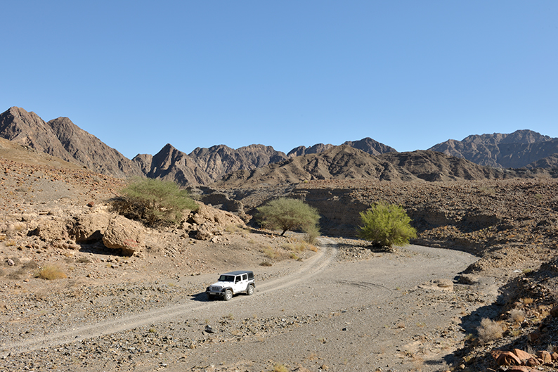
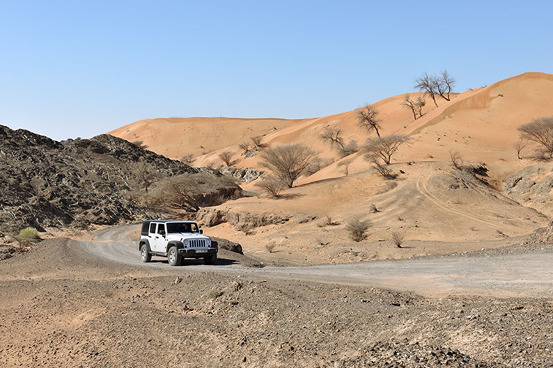
Driving through the Al Hajar mountains. - 4×4: As outlined above, a real 4×4 is the obvious choice. It has the off-road capacity to take you everywhere safely on this trail, no matter how technical it may get.
- Tires: All terrain tires are a minimum if you want to avoid punctures. Road and sand tires are to be avoided. Have a spare in good condition with you and a puncture kit for emergencies. (Learn how to use it before you’ll need it)
If you are renting a 4×4 ask for AT (All Terrain) tires with your 4×4.
- Enhancements: No modifications are necessary for this trip. I belong to a very small group, that believes a 4×4 is best kept in its original specifications. Driving a vehicle well thought of by experienced engineers and tested thoroughly by qualified technicians, sounds safer to me than an “artistically” modified “beast” assembled by a local backstreet garage. To each its own !
If you don’t have one, you rent one at the following locations listed on a great article from a great blog on Oman I invite you to consult.
Beyondtheroute.com
Other rental companies are:
Nomad tours. (They offer true off-roading packages and insurances)
Nomadic desert camp (Renting 4×4 but desert off-roading is at your own risk, understand not covered by insurance) - Tires: All terrain tires are a minimum if you want to avoid punctures. Road and sand tires are to be avoided. Have a spare in good condition with you and a puncture kit for emergencies. (Learn how to use it before you’ll need it)
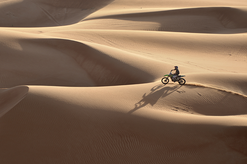
- Motorcycle / Quad: It’s not the size that matters, some complete the Dakar race on 125cc machines. It’s how you drive it and its fuel autonomy that matters (The Ar Rub al Khali spans distances of over 500 kms between refueling). Keep it light, some of the climbs are really really steep and too much baggage will really drag you down.
Listed on the following routes are all the fuel options along the way. Plan your fuel needs accordingly.
I know nothing more thrilling than exploring the desert on a bike. - 4×4: As outlined above, a real 4×4 is the obvious choice. It has the off-road capacity to take you everywhere safely on this trail, no matter how technical it may get.
- Driving tips:
if you are not familiar with off-road driving we strongly suggest you spend time reading our beginners guide to off-road driving. However, If you have no experience and plan on doing this alone, you are looking for a lot of troubles. More on solo driving below.
- Basic rules: First and foremost you must follow and stay on the indicated or visible track.
A – because it’s the best way not to get lost,
B – because the mountain terrain is way too hazardous to allow you some improvisation safely.
A common mistake is to take a wrong path, and then decide to “cut through” to get back on the right one, instead of safely going backwards to the point where you took the wrong turn. What seemed like a short cut is 9 times out of ten a recipe for disaster.
C – Do not enter a portion of the trail if you don’t feel capable of passing through. Turn around when you still can. There is no shame in knowing your limits. A u-turn under stress on a narrow track shouldering a cliff is not a fun nor safe experience, reversing is even worse. When in doubt, get out of your car and walk it first to make sure you know what you are getting yourself into. Then take your decision. There are many alternatives available for you on the trail.Most of the trails you will drive on are vital to local villagers and as such are in general well maintained… That is until it rains. Rain running down mountain slopes will follow the easiest path available to reach the wadi below. That path is your trail. In doing so, it will create trenches, gulleys and displace rocks of all sizes. It may even take down entire stretches of the trail if passing through it perpendicularly. For some, it is when the real fun begins, for others this is when unwanted complications will slow you down.
- Sand: Check out this dedicated post.
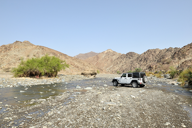
- Wadii: A wadi is a river bed. Most of the time it is dry. But that can change in a matter of minutes in case of rain. Flash floods are a real hazard in this region and claim the lives of careless travelers every year.
Do not enter a narrow wadi if it is raining or the sky is menacing.
When confronted with water crossing. Before entering, first check how deep the water is and how loose the ground underneath it is. In most cases it is very shallow as seen on the picture below and doesn’t require any particular skills. However, when in doubt, get out of the car, cross it on foot first all the way and back before engaging your car. If the water is deep enough to reach your brakes, once on the other side, press a couple times on your brake pedal to make sure they have not been affected by the maneuver.
Do not attempt to cross during a flash flood. Instead, wait for the rain to stop and the water to go down, (it can happen rapidly and is well worth the wait), or simply turn around and find another way.
- Mud: Your chance of encountering mud on this trip is very slim. It only happens after a brief shower and usually dries rapidly. It is very similar to driving in sand. Good traction, the right gear and momentum is what matters.
When confronted with mud, stop, assess the obstacle, deflate your tires for increase traction if you deem helpful, select the right gear combination and enter. Do not engage too fast by fear of getting stuck in the middle, chances are you will slide, spin your wheels and get stuck or worse hit too hard an obstacle you couldn’t see at first underneath and break something.
If stuck in mud. Either get towed out if you are in a group, or get your Maxtrax or winch or a shovel if you are alone. If you have nothing like that with you, (then you are ill prepared !) pile rocks you can find around you underneath your tires to get better traction.
- Driving at night: Besides the obvious safety issues, what is the point ? You are on this trail to admire the landscape.
The main reason why you might be tempted to drive at night is most likely to be because you want to reach a pre-determined campsite and you’re late. Don’t ! In case you realize you are not going to make it on time, look around you and find a suitable space while it is still daytime. There are plenty along the way. Just don’t settle for a spot in the middle of a wadi bed. As mentioned before, flash-floods are a serious threat to your life.
- Solo or in a group ?
It used to be a choice, but lately the authorities patrolling the borders of Yemen and Saudi Arabia are becoming more and more present and don’t see you venturing alone in those areas as a good thing. As such they will turn away solo drivers. (better be fluent in arabic if you want to argue) They may also re-route convoys based on safety concerns. It doesn’t mean the area isn’t safe, or that you can’t do it alone. It just means that it is not encouraged because they don’t want to have to come rescue you if you get stranded.A group is almost always a safer way to enjoy this or any other adventurous endeavor. But it requires more organization and more discipline than going away on your own. When planning a group “expedition”, there is a lot more at stake than group chemistry. Being good friends is great, but it is not enough. Everybody must bring something to the team. Being responsible and in charge of a needed skill. May it be driving, navigation, mechanic, cooking, language, etc… A group of 10 drivers where nobody knows how to fix a flat tire, understands a map, doesn’t speak a word of arabic or ever started a fire, is not a team but a moving traffic jam looking for trouble.
A team needs a leader, a person with authority that can open the road and guide others according to everyone’s potential. It takes a lot of experience and psychology to be a leader. It also needs a second “in command” sweeping at the back of the convoy, helping those in trouble. Communication among all team members is key. (However, it be noted for those coming from Dubai, that Walky-talkies are illegal in Dubai and can be confiscated at the border when returning from your trip. I had mine confiscated after a meticulous 1 hour search of my vehicle at 3 AM in the morning at the border. – No Comments – )
Make sure you build a qualified team around you and try it on a few short outings before making the big jump.On the other hand, solo driving offers more freedom and flexibility but requires a certain amount of experience in many domains as you will have to solve every challenge that comes your way on your own. Now, if you are coming to the region for the first time, are on your own to do this trip, have no experience with off-road driving in this environment, speak no english or arabic, it goes without saying that renting a car to tackle this trail alone is foolish at best, and I can’t be held responsible for all the troubles you might get yourself into. You’ve been warned !
- Fuel: There are many gas stations along the way, all indicated by gps points. The only section where gas will be an issue is when crossing Ar Rub al Khali, where you’ll need to carry extra. As a general rule I always carry an extra 20L Jerrycan of fuel in case of an emergency (But I have a long range with my car you may not have – plan accordingly). I also refuel whenever I can regardless of how much gas I have left. Always play it safe. Know your car’s range and average fuel consumption based on encountered terrains to avoid surprises. As an example, there is a big gas-mileage difference between my Diesel Jeep Wrangler Unlimited and a 2 door petrol version. Study the trail before venturing out. Look at the distance between each gas station on google earth, check the opening hours of the various stations and if they carry your specified requirements. We have listed them in our daily route breakdown below.
There is also a substantial consumption difference between driving in 2WD or 4WD mode. Stay in 2WD as much as you can will save you a lot of gas.
- Equipment: Less is more. Why ? Because weight is your enemy.
We live in a society that thrives on consumption, where marketing gurus will have you feel naked unless you possess everything for anything. Through ads, brochures and reviews, they will lead you to believe that you can’t do in life without the latest, the most, the best, the highest, the biggest and the useless. I, too, at first, felt for it, thinking I needed to look like an explorer to explore, convinced my safety, my comfort, worst, my credibility depended on it. And while most of the inhabitants you will meet while exploring remote areas, thrive with close to nothing, we feel obligated to carry the world with us to just survive. It not only has a cost, it also has consequences. The heavier you are, the harder it gets to move it. It’s called weight versus performance. Or how a simple climb can quickly become an Everest because you took too much useless stuff with you.Here is a list of what I bring with me.
Crossing a Wadi - Basic rules: First and foremost you must follow and stay on the indicated or visible track.
- Camping.
Camping in the desert Camping is for me one of the best part of the trip. A night under the stars, enjoying a good book by a fire, away from the crowd and the noise… Is easier said than done ! And like everything else, it requires proper planning. As a rule, you should know where your next campsite will be, as you leave the previous one. Do not set your mind on a single option. Instead consider several locations listed on your way to account for potential delays and other complications. Understand the more attractive the site you selected is, the more popular and crowded it may be. Make sure to consider week days and week-ends. A white sandy beach at the end of a beautiful wadi might be a good choice on a Tuesday night, but will most likely be a very crowded party spot on a week-end.
Try to set up camp an hour before sunset. Finding the location, unpacking, getting your tent up in the dark is not as nice, worse can lead to unpleasant surprises.KEEP THE PLACE CLEAN.
I shouldn’t have to say this, and it should be obvious to anyone. Unfortunately it isn’t. Do not leave anything behind. No one is here to clean up after you !!I have tried to list as many potential sites as I could, feel free to improvise if you find a spot you like. In some areas, due to the terrain, your options are minimal, in others, there was just too many possibilities to bother listing them. As it should be obvious, just respect your environment and the people around you.
- Other activities.
Trekking, climbing, canyoning, etc…
Because there is a lot more to do than just drive. The Al Hajar mountains in particular offer great outdoor opportunities. Bring along with you the required equipment to explore the surrounding wonders. If interested in trekking through the Wadii, you need canyoning equipment, specially if interested in Wadi Awf in Jabal Akhdar. In Wadii Shab and Tiwi, you’ll need to swim your way through. Finally, to take advantage of the Majlis Al Jinn Cave you need the ropes and other specific equipment to go down and back. This guide won’t get into the specifics of each activity and the skills and tools you need to bring along. It is understood that if you decide to explore out, you have the experience and ability to do it.
THE ROUTE
Muscat
(I should call it day 0, because you’re not yet on the trail. This day should be spend preparing yourselves – Arriving in Muscat, getting your rental car if needed, buying food and water, and visit as much as you can in Muscat before heading out tomorrow for what will officially be your first day – you’ll have a second chance at the visit at the end of the journey if you can’t see it all this time around.)
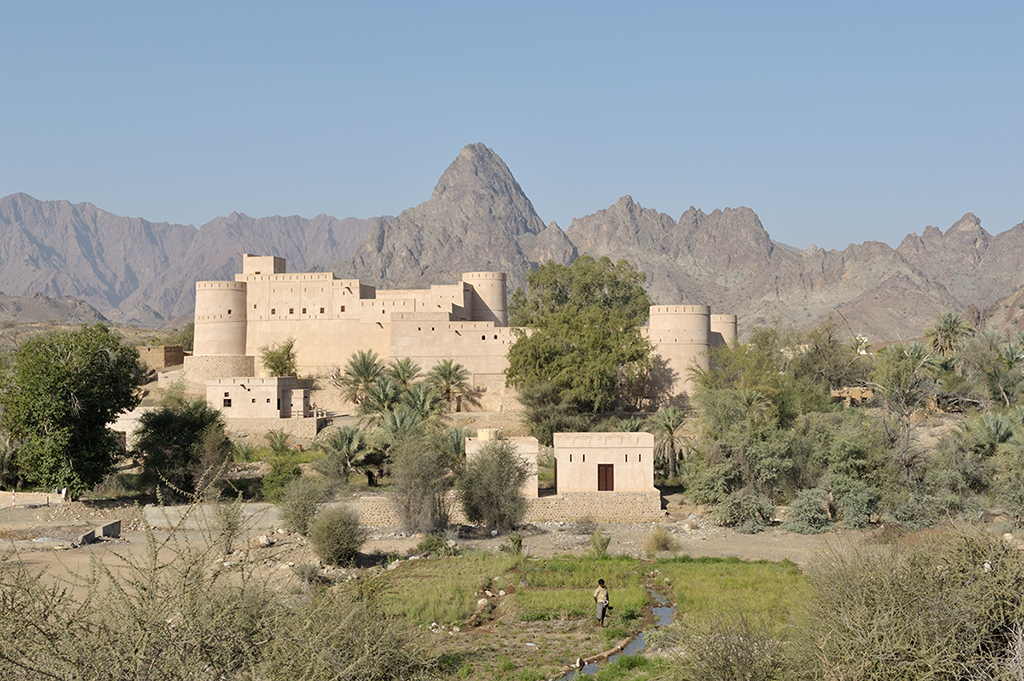
The Muscat you see today, began its expansion in 1970. Before that, the small port (Muscat in arabic means anchorage) would find comfort behind its walls and surrounding mountains and close its access at night. Inside the gates of Al Bab Al Mathaib, Al bab Al Kabir and Al Bab Al Saghir, you had to use your own lantern to walk around at night. The old town dates back to the first century BC. It will remain a quiet fishing harbor until the XV century when its deeper waters attracted the bigger merchant ships looking for a safe place to land on the coast. That is exactly what will bring the Portuguese to the area a century later, turning Muscat into a well protected naval outpost for their boats. The forts they build on each side of the bay, the Mirani fort, completed in 1587 and the Jalali fort finished in 1588 are still here to remind us of their presence. (you can’t visit them however)
Al Muttrah is the most visited area of Muscat, and shows how the authorities managed to mix in a pleasant manner old and modern buildings, keeping the authenticity of the place intact.
I recommend you spend time here and visit the Omani French Museum, (Open in the morning only, Sat to Wed.) Built for Ghaliah bint Salim, niece of Sultan Said bin Sultan, this remarkable building was offered to Paul Attavi, first french Consul in Oman in 1894, by Faisal bin Turki al Said. The other interesting site to visit is the Bait al Zubair house on Al Shaidiya street. (open from Sat. to Thur. 9H30 am to 1pm and 4pm to 7pm) Here you see collections of local costumes, jewels, arms, as well as a replica of a traditional Omani village in its park.
You should also visit the old souk. It has been modernized yet still feels authentic, (not as much as the one you will see in a few days in Nizwa, but nevertheless a great place to find true local produce and goods.) The other point of interest in Muttrah is Bait al Baranda, (open from Sat. to Thru. From 9am to 1pm and 4pm to 6pm) where you can study the geological and anthropological history of Muscat.
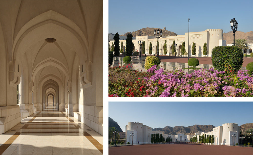
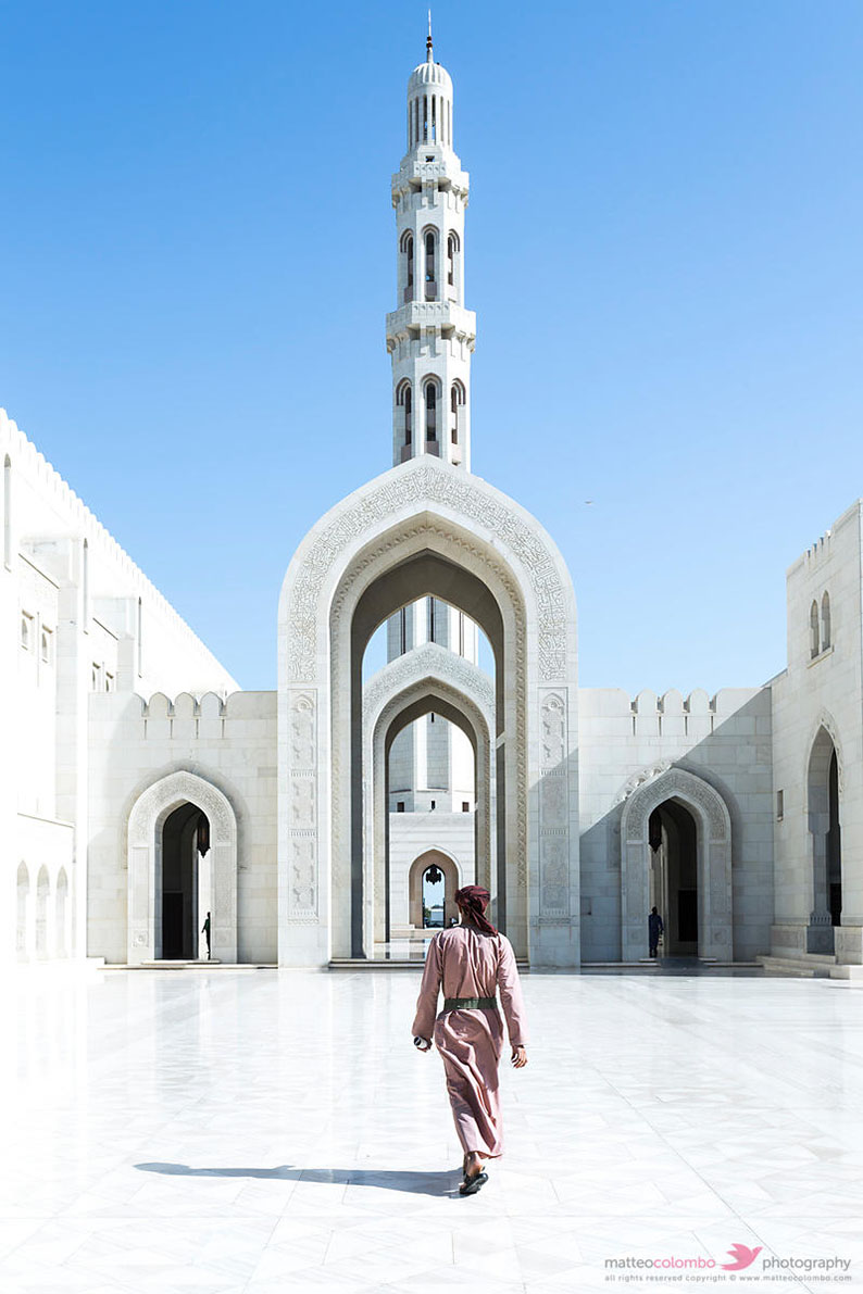
Saved for last, the main attraction in Muscat is the new Sultan Qaboos grand mosque. (open to non Muslims Mon. to Thur. 9am to 12am)
Your options for the night.
Either spend the night in a Hotel, camp in town or leave Muscat after your tour, and reach the beaches further down the coast for a first night in the Bandar al Khiran. (Consider the date you’re starting your trip on. If it’s a week-end – Thursday or Friday night here -, forget about the latter option as it will be packed with people enjoying this heavenly spot on their day off)
Local Hotels
There are plenty of hotels in Muscat for you to choose.
I suggest you check Booking.com for a better idea as I can’t list them all.
I recommend the Ibis Hotel. It’s clean, comfortable and reasonably priced.
For those of you on a bigger budget, you also have the Crowne Plaza Hotel on the beach, or the Shangri-la Barr al Jissa Resort down the coast, and if the sky is your limit, the famous Al Bustan Palace hotel further along.
Campsites
The second option is to camp in town on one of the local beaches. Again consider the day of the week. Week-ends can be busy here too.
Ras Al Hamra beach 23°38’32.19” N – 58°29’54.68”E is a good option, tuck in a little cove. Or The Qurum beach 23°36’28.52” N – 58°26’11.78”E with its extended stretch of sand offers a broader and quieter choice if on a week-end.
Now for a truly stunning site, but again to be avoided on week-ends (Even though I have listed a harder to reach cove that is most of the time deserted regardless of the day) you can leave Muscat and drive down the coast to the Bandar al Khiran. If that is your choice, follow the directions starting below with the Day 1 drive.
Day One
Muscat to Dibab
160 km.
Introduction.
Time to start our Journey and leave Muscat behind. Today you will have a first taste of the Al Hajar mountains, (See a more detailed description below) its Jebal and wadii. On the menu is the Ra’s al Khiran, a magnificent cove with turquoise waters, Wadi Huyfahd, the geological treasures of Wadi Salil, the ancient fort of Quriyat, Wadi al Dayqa and its dam, and at the end of the day one of Oman most beautiful sites, Wadi Al Abriyyin, where you’ll be able to dive in its fresh water pools, before a night on a white sandy beach facing the Indian Ocean.
The Al Hajar Mountains.
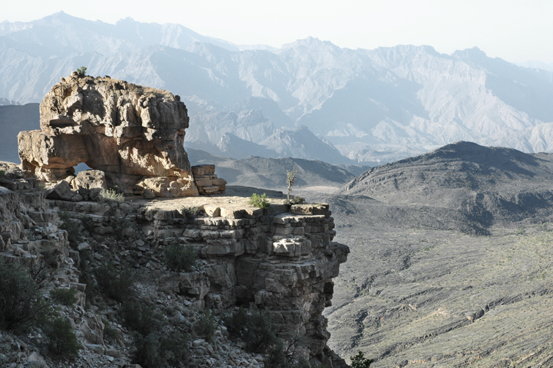
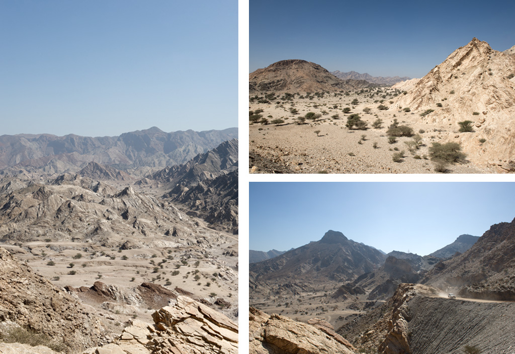
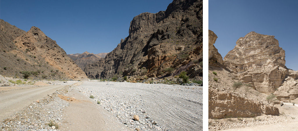
Al Hajar mountains, understand in english; the Rocky mountains. Hard to find a more obvious choice for a name to describe this spectacular mountain range. A mix of limestone, ocean crust and earth upper mantle exposed as nowhere else in the world, making this region a geological wonderland.
Located on the eastern corner of the Arabian peninsula, standing tall above an ocean of sand, it began its formation when the old Afro/Arabian plate moved towards the Asian plate. As a result, the crust and deep mantle of the Indian ocean were pushed upwards over the edge of the tectonic plate. This ongoing obduction and subduction process created a massive structure of various rock formations; ophiolites, metamorphosed ocean sediments, limestones, Hawasina and other exotic sediments piling up vertically above sea level during the late Cretaceous (90 – 75 million years ago), before eroding rapidly, and falling under see level again, where shallow marine sediments began to cover it again.
It’s only 30 million years ago, during the late Oligocene, that a new and still active uplift re-exposed the rocky mountains we see today. All this movement is believed to be related to the separation of the Arabian and African plates, with the opening of the Red Sea, and the resulting shift towards the Eurasian plates, where the Zagros mountain range in Iran erected simultaneously.
Maps will separate the range in two geographical entities; the Eastern Hajar – Al Hajar Ash Sharqi – and the Western Hajar – Al Hajar Al Gharbi -, separated by Wadi Samail near Muscat. In reality the true distinction lays geologically between the Musandam Peninsula, also called the Ru’us al Jibal (the head of the mountains) and the rest of the range, starting on the Fujairah Emirate border by Dibbah. The Ru’us al Jabal is mainly composed of Mesozoic carbonates sediments, found barried under sand throughout the rest of the arabic Peninsula, while the remaining part the range is a mix of solidified lava from the ocean crust and upper mantle formed deep within the earth called ophiolites, mixed with shallow water sediments and limestones.
Recommendations.
There are plenty of gas stations along the way today. The drive off-road is fairly easy, I recommend to deflate your tires to 20/25 psi for cars once you leave the tarmac for the first time and keep it that way all day. (No point re-inflating each time you get back on the road, the stretches of tarmac are short. Just drive with caution at all times). The distance is not very long so you can stop often and enjoy the beauty around you.
The drive.
Starting Point.
23°36’44.50” N – 58°35’37.83”E
Those are the coordinates of the round-about facing the old town mall. From here take on Al Saidiya Road going up towards Al Bustan.
23°35’24.84″N – 58°35’58.77″E
You have a gas station on your left.
23°34’03.00″N – 58°36’29.17″E
At the round-about take right on An Nuzhah st.
On your left at the round-about is the famous Al Bustan Palace hotel. (My wife would call it your last chance at a decent place to go to the bathroom for a long long while!)
23°33’38.32″N – 58°35’49.11″E
Exit An Nuzhah St., pass underneath An Nuzhah St. unto Qantab Rd.
23°33’25.06″N – 58°35’56.89″E
Turn right on the small road climbing up.
23°33’10.62″N – 58°35’58.82″E
You’re about to leave the tarmac for a dirt trail for a short while. No need to deflate yet or engage in 4-wheel-drive.
23°33’21.59″N – 58°34’05.00″E
You’re back on tarmac. Take a left on Tiwi Rd. all the way until the first round-about.
23°31’25.94″N – 58°38’01.00″E
At the round-about take right on the first exit.
23°30’29.78″N – 58°39’33.69″E
At the Y intersection, you have two options. Taking left towards the beautiful Ra’s al Khiran, or take right and follow our day trail towards the wadi.
I strongly advise you to go check the coves, but if you want to skip the diversion click here.
The Ra’s al Khiran diversion.
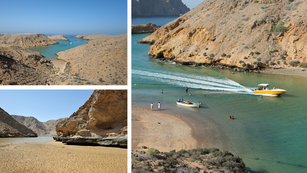
Ra’s & Bandar al Khiran form a secluded cove with coral reefs, ideal for swimming, snorkeling and diving. It is also a beautiful place to camp, and I have listed it as an option for your first night in Muscat if you don’t want to sleep in a hotel.
If interested in the cove, and you should, take left at the Y junction, then the first right, and left again at the following Y junction. Follow that road.
23°30’49.55″N – 58°41’02.34″E
Track leading to a quiet campsite in an isolated cove. Only take it if you plan on camping there. Otherwise stay on the main road.
To reach the camp site:
On your right is a construction workers compound. On your left is a smaller unit. Enter the dirt track on your left pass in front of the building, cross the large dirt field on its right, and enter the track starting on its left corner.
At the first Y junction, take the smaller track on your left. At the next T-junction keep straight. Next Y junction take right. Stay on that track on the way to the beach.
Do the trip backwards to come back to the road.
23°30’49.55″N – 58°41’02.34″E
If not interested in camping there, keep straight on the main road all the way to Al Khiran. You will pass several coves on the way.
23°30’15.21″N – 58°43’55.00″E
To access the cove take left.
23°30’52.25″N – 58°44’31.44″E
Leave the main track for the dirt track on your left. You’ll see a small parking at the top, before the track goes down towards the cove. It’s a bit steep but nothing your car can’t handle. If you’re only visiting and don’t plan on camping for the night, you can park up and walk down.
Once down get back the way you came all the way to 23°30’29.78″N – 58°39’33.69″E and get back on the main route.
End of the Ra’s al Khiran diversion.
23°30’29.78″N – 58°39’33.69″E
Take right at the Y section, then right again at the following Y section, then right on the main road.
Keep straight on that main road.
23°30’00.85″N – 58°39’52.29″E
This is where the fun begins. You’re now entering your first wadi. Time to lower your tire pressure to 20/25 psi for better traction and comfort.
23°29’14.03″N – 58°39’54.17″E
At the Y junction, take right.
23°25’57.52″N – 58°39’22.33″E
You’ve reach the small hamlet of Ash Shiqayri, stay left on the main track at the T junction.
23°26’00.36″N – 58°41’06.14″E
You’ve reach the small hamlet of Al Khityah, stay right on the main track at the T junction, re-entering wadi Hyufahd.
23°24’29.66″N – 58°41’43.00″E
At the y junction, stay right. Follow the main track along the wadi.
23°22’40.17″N – 58°40’48.80″E
As you reach the top of the pass, park along the side for a great photo.
23°22’20.77″N – 58°40’33.45″E
At the Y Junction take left towards Al Silil. Once you reach the road, take right towards the main road Highway 17.
You’re about to be on tarmac for a short while. It is too short to bother re-inflating your tires. However, just drive with caution at a top speed of 80 km/h on Highway 17. Put your warnings on to inform others.
23°21’31.86″N – 58°40’41.42″E
Pass over the Highway on the bridge in front of you, and enter on the other side towards Sur.
23°14’51.62″N – 58°47’15.65″E
Exit the Highway, get to the round-about and pass over the Highway till the next round-about on the other side. Take the first exit on your right. Drive all the way till the T-Junction. At the T-Junction take right and stay left on the dirt track leading towards the wadi.
You’re about to enter Wadi Salil. If you re-inflated your tires before getting on the Highway 17, time to deflate again to 20/25 psi.
This Wadi is of high geological interest. Boards along the way explain the various stone formations seen through out.
23°15’12.85″N – 58°47’31.96″E
You are now entering Wadi Salil. Follow the main track all the way through.
Caution: Wadi are subject to flash floods. You should not enter in case of rain, as you could be flushed away.
I will not repeat this at the entrance of every wadi, I assume that by now it is understood.
23°15’45.45″N – 58°53’20.42″E
This is the end of the wadi, you’re now entering the small town of Quriyat or Qurayyat. Keep straight left at the Y-Junction.
Quriyat
.
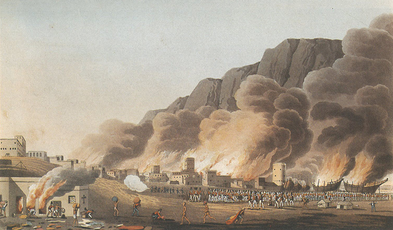
The small coastal village of Quriyat comes to life in the early morning hours as local fishermen take off to sea, and when they return a few hours later to unload their catches on the beach. (This can be said of every coastal village you will pass on the long coast of Oman). Beside fishing, the area was also known in the past for its horses, raised and exported by local merchants, which brought extra wealth to the town. That was until the Portuguese, lead by Alphonso Albuquerque, raided the town in August 1508 and set it ablaze. Keeping the town under their rule, holding the inhabitants captive, the Portuguese were finally ousted by Imam Nasir Ibn Sultan Al Yurabi in 1648. It is under his rule that the fort was built. Other sources claim it was build by Sayyid Saeed bin Khalfan al Busaidi some two hundred years ago. As always finding out the goods about local architecture can be tricky.
When the government decided to renovate the fort, it transformed it into a museum displaying authentic Omani historical artifacts and handicrafts, as well as books. Rooms have been refurnished to show you how it used to be.
23°15’51.93″N – 58°53’47.32″E
Take right at the junction, leaving the Wadi bed to enter the town. Follow that street (Al Musalla St.) all the way till its end, and turn left in Al Hesn St. (I’m noting down the street names for reference, but they are not often marked, and not always in english. So don’t try too hard to find them. Just Turn left) Having a google earth print out of the various towns along the way always help if you don’t have downloaded the GPS trail.
Once on Al Hesn St. stay on that main street towards the town Fort.
23°15’55.05″N – 58°54’56.40″E
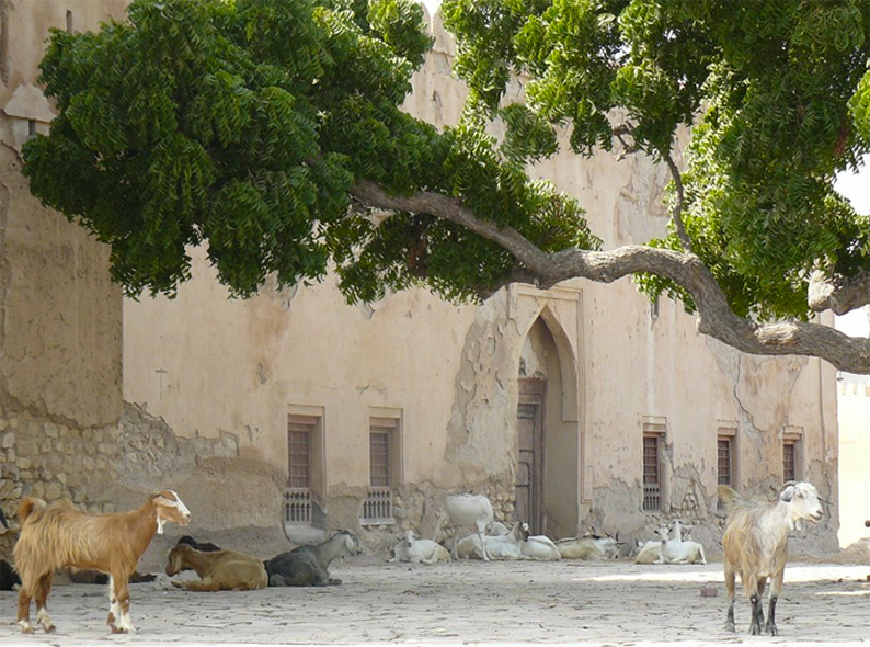
This is the old town fort. Park in front and have a tour. It has been recently renovated. Opening hours are week-days from 8h30 to 14h30. At the time of writing their was no admission fee. A local guide was offering a brief tour rewarded by your generosity, as it is often the case in smaller cultural attractions.
From the fort drive East towards the beach. Once at the beach turn right, pass the small Harbor, follow the road right towards Al Hesn St.
23°15’21.04″N – 58°54’37.72″E
At the T-Junction, take left on Al Hesn St.
23°14’34.46″N – 58°54’11.21″E
You have a gas station where you should refill. (There will be two more options for you before you enter the wadii)
23°13’34.56″N – 58°53’40.73″E
Second gas station, this time on the other side of the road.
23°12’37.52″N – 58°52’12.00″E
At the T-Junction turn left. A third gas station is on your left.
23°12’14.34″N – 58°52’39.00″E
At the round-about, take the second exit, to pass above the Highway 17. On the other side, at the round-about take the first exit on your right.
23°11’02.09″N – 58°53’13.75″E
At the T-Junction, take right.
23°09’59.17″N – 58°52’06.00″E
At the T-Junction, take left. You are on your way to Wadi Al Dayqa.
23°08’01.45″N – 58°53’43.30″E
Two choices. Either take left on the dirt track to reach Wadi Al Dayqa, or stay on the road towards Wadi Al Dayqua Dam and Al Mazan castle. If you choose to go to the dam and castle, you can come back to this point and then go on the wadi, or catch up later at the end of the wadi as described below.
Wadi Dayqa Dam diversion.
You decided to go check the dam and its reservoir lake, as well as the castle. Follow this road all the way to:
The Dam
23°05’41.52″N – 58°51’04.37″E
Take right towards the gate and follow the sign to the parking. Once done admiring the dam, come back to this point and turn right towards the town, staying on the main road curbing to the left. Cross Al Mazari, then the wadi, by now you can see the castle on the hill top. As you arrive at the T-Junction next to the local school, take left. Stay on this road, at the Y-Junction in front of the house with the “elaborate” stain glass windows, take left towards the castle, the left again at the next cross road. The castle is straight in front.
The Al Mazan Castle.
23°05’02.50″N – 58°52’04.01″E
This castle fort is in ruins, and cannot really be visited. But is still interesting to see. It reveals an organization you will see again and again throughout the mountains of Oman. A Hamlet located on the edge of a wadi, with its palm date gardens by the water, overlooked by a fort on a hilltop, protecting it and the mud brick houses surrounding it. Inside the fort is often found a well and a mosque, in case people had to found refuge and sustain a siege. Further along the wadi, on other hilltops, watch towers here to alert the inhabitants about coming dangers.
Once done with the castle you can backtrack to the original wadi entrance, or get back to the road you just left, turn and go down towards the wadi, cross it, then back up on the dirt track called Al Ya road (there is no sign indicating the name anywhere).
Stay on that main dirt track till you reach 23°04’59.62″N – 58°55’01.76″E.
I strongly advise you to go back to the entrance of the wadi, before the diversion. It’s a bit rocky at times, but well worth the drive.
End of the dam diversion.
If you decided to skip the dam.
Wadi Dayqa.
23°08’01.45″N – 58°53’43.30″E
You have a dirt track on your left leading to Wadi Al Dayqa. (if you are coming back from the dam, the track is logically on your right). There is a gate closing the access, but there is plenty of space on the side for you to pass anyway. (at least at the time of writing. If the access is for some reason blocked for you, turn around, drive back to the T-Junction 23°09’59.17″N – 58°52’06.00″E and take right towards Hayl Al Ghaf. Follow the road all the way to the wadi and enter there. It’s a great drive, but a bit more technical than the proposed section)
Pass on the side and carry on. As you reach the large wadi about 700 meters later, turn right and follow the main track. You’ll see the remnants of an old falaj on the side of the mountain on your right. There will be a few water crossings along the way, most if not all very shallow.
23°05’56.04″N – 58°54’20.29″E
Time to exit the wadi for the dirt track on your left.
23°04’59.62″N – 58°55’01.76″E.
You’ve reach the connection with the dam diversion. Keep straight.
23°04’50.38″N – 58°55’31.74″E.
You have a small faint track going straight as the main track curbs left, stay on the main track going left.
23°05’11.75″N – 58°56’58.57″E.
You’re reaching a road. Do not get on that road. Stay on the dirt track on the right side of the road as it goes up and turns right. Follow that track.
23°03’52.84″N – 58°57’07.78″E.
At the Y-Junction take right.
23°03’02.48″N – 58°56’50.24″E.
At the cross road, take left. In front of you is a Hamlet called Fayq.
23°03’07.14″N – 58°57’10.00″E.
At the Y-Junction take left, going down the wadi is also an option but more complicated.
23°03’22.70″N – 58°57’49.62″E.
Keep straight.
23°02’42.93″N – 58°58’33.94″E.
You’ve just passed a school on your right, down on your left is Wadi Al Abriyyin. Keep straight to reach the village of Al Suwayh and its clear water pools. You will have to come back to this point once done to follow the route.
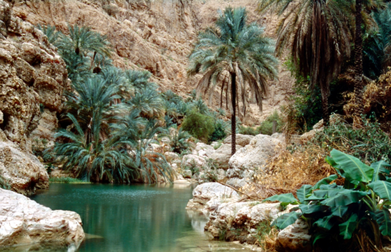
The track will take you to a dead end at 23°01’56.76″N – 58°59’29.73″E. Park where you can without disturbing the local villagers. You’ll see a series of pools where you can take a swim. Ropes have been set for you to climb out of the pools. Be very careful and check first before jumping in that the ropes are there, and that you are physically capable of pulling yourself up. Each year, tourists end-up dead in such pools because they could not climb out of them. Also take the time to admire the village.
23°03’22.70″N – 58°57’49.62″E.
You are back at the junction, after spending time at the pools. Turn right down towards the wadi bed, passing through the small village called Al Batha. You’ll follow the track at the bottom of Wadi Al Abriyyin all the way till the end. Again you may have to cross the water now and then. It’s shallow and doesn’t present any real difficulties unless a major rain storm happened the days before !
At the end of the wadi, you’ll pass underneath the Highway 17. Right after you’ll reach a road. Take right on that road taking you to Dibab, and then the beach. Stay on that road as it follows the coast.
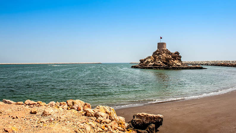
The Hawyat Najm park.
23°02’28.97″N – 59°04’23.15″E.
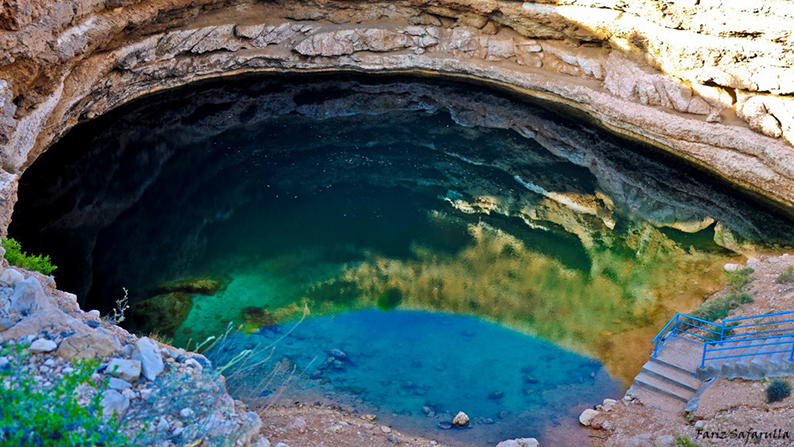
At this T-Junction turn right. This dead end will take you to the sink hole, locally called the Hawyat Najm Park, which means the meteor fall park. Now that name is misleading, as no meteor fell here. The hole is due to natural erosion of the limestone and is connected to the sea by caves and tunnels. The entrance of the park is free and it closes at dusk. You can have a swim and use the cabins in the park entrance to change and wash up.
Once you are done with the visit, get back to the road and turn right. And start looking for a spot on the beach to camp.
23°02’02.00″N – 59°04’53.30″E.
A great place to camp on the beach.
Note that the area is very popular on week-ends (Thursday and Friday nights here) attracting a lot of people for barbecue and camping on that particular spot. As such, the idyllic isolated beach front can rapidly turn into a loud and busy party place where you won’t find sleep until very very late. The rest of the week it’s pretty much deserted.
This is the end of day one on the trail.
Day Two
Dibab to Fins
94 km.
Introduction.
I hope you had a pleasant night on the beach, time get back up in the mountains.
Today we will enter the Salmah Plateau Natural Reserve, admire the Jabal Bani Jabir Beehive tombs, explore (if you have the skill and equipment) the Majlis Al Jinn cave, and trek the Wadi Fins, before returning to the beach for another night by the ocean.
Recommendations.
Today is very short but a lot more technical. It is done to give you the time to explore the cave and/or trek Wadi Fins. Because of the technical aspects of the drive you have a possible “escape route” that spares you some of the most technical parts. (Nothing that dramatic either) The climb up to the plateau, as well as the descent back from it are very steep and will get used too. But in the end you should find it fun !
You will need to engage in 4-Wheel-drive today, you may even need to use the Low range. Your tires should still be deflated to 20/25 PSI.
The drive.
23°01’54.41″N – 59°04’58.62″E.
As you leave the campsite on the beach and get back on the road, take right at the T-section all the way straight to the round-about. There, take the third exit going left to reach the gas station, food store and tourist information center by the main road. Refill and get the food you need if the store is open. Gas stations are not all open 24h a day in Oman. However they open very early. (I remember stoping there at dawn as they were just opening for gas. The store and information center were still closed). You’ll find a small food stuff market in Bimma a bit down the road. (Don’t expect much choice there, it is not a super market by any mean)
Once you’re done get back to the main road on the coast and turn right. Stay on that road all the way to Bimma. Look for the store if you need supplies (there won’t be any other shop on the trail for the rest of the day). Then pass Bimma all the way till the next road T-Junction at:
22°58’50.74″N – 59°09’10.14″E.
At the T-Junction take right. Stay on the road as you pass underneath the Highway 17 and reach the Park entrance sign.
Salmah National park.
22°58’08.50″N – 59°08’32.06″E.
As the road changes to dirt, you can see on your left a small building. It’s the Park rangers post. You’re about to enter the Salmah plateau “national park”. You’ll also see the sign in english telling you It requires a permit to get in as it is a protected area where you can’t camp, build a wild fire or go off-road, etc.
As far as the permit, I have never seen anyone there selling it, nor anybody answer the provided phone number listed on the sign. So don’t stop at all, just drive on as a local, but respect the environment you came to admire as mentioned on the sign and all will be fine.
(If somehow you were stopped by a park ranger, just ask how much is the permit, and buy it (and get back to me to let me know so I can update this guide and inform others.)
The road climbs nicely upward, engage in 4-wheel-drive if you feel like you need it.
22°57’44.15″N – 59°08’25.21″E.
It should be obvious, but just to be safe, Stay on the main track going left. It goes for the rest of the way. The main track is obvious.
22°55’07.05″N – 59°05’42.61″E.
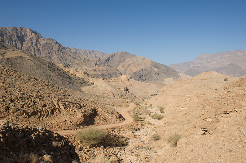
At the Y-Junction take right. It’s about to become fun as the track climbs straight up (23.9% at one point) towards Jabal Qatar and the high Salmah plateaus. The track is not as good as previously. Drive with caution, avoids the rocks and the holes. 4-wheel-drive high is enough to climb.
22°53’36.00″N – 59°02’03.79″E.
On your left is the second Park ranger house. Again, most likely to be empty, just drive by and admire the stunning beauty of the environment.
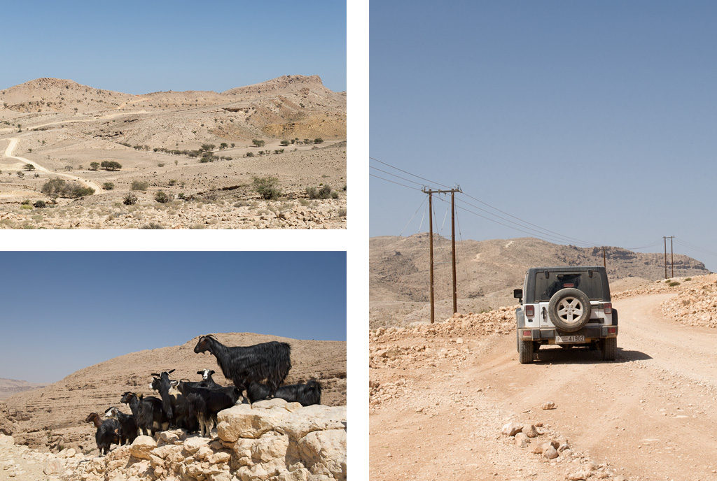
The plateau is the land of goats. In the distance (picture up left) women guide the herds from pastures to pastures.
Note: You may see herds of goats shepherd by local women. Do not try to take pictures of them up close. It would be considered disrespectful.
22°53’28.43″N – 59°01’48.51″E.
At this junction you are meant to go straight. Now if the climb up to the plateau made you very uncomfortable because of the height or the technical aspect of the drive, you might want to turn left instead and cut through. The track going forward is a magnificent trail but offers a few passages on the edges, steep ascents and descents that make that stretch a very fun drive, but I guess not for everyone. Your call.
Diversion.
If you decide to cut through, Stay on the main track till the Y-Junction at 22°52’17.72″N – 59°02’16.70″E. Were you’ll keep right. Stay right again at 22°51’45.57″N – 59°02’04.88″E. As you pass the house on your right. Right again at 22°51’46.39″N – 59°02’02.74″E. Stay on the right at 22°51’02.04″N – 59°02’06.57″E. Pass the new village on your left, straight on till 22°50’23.48″N – 59°02’14.51″E. Where you’ll take right then left at the Y-Junction (the right track leading to a small village. The next T-Junction at 22°49’57.74″N – 59°01’30.37″E. Catching our main trail. There turn left.
For those carrying on with the trail go straight.
22°53’38.86″N – 59°00’34.36″E.
Let the fun begin with a passage down at 18%. Drive down with caution towards the bottom of the wadi where you’ll see a small Hamlet. When the drive becomes too steep down, engage in 4-Wheel-drive Low.
On the other side of the wadi, just climb back up and follow the main track.
22°52’43.22″N – 58°59’36.12″E.
At the junction take left. There will be junctions along the way reaching small houses. Stay on the main track forward.
22°50’07.57″N – 58°59’35.60″E.
At the Junction take left, and left again at the next one, and the one after as your track keeps on climbing back up to the plateau. There will be a few instances were you’ll need to get in 4-Wheel-drive Low to climb.
22°49’33.52″N – 59°00’42.92″E.
On your left is a small “cafeteria/drinking place”. I have yet to see it open, but friends have told me it does. If it is feel free to stop and check it out.
Regardless just turn left at the intersection.
22°49’57.74″N – 59°01’30.37″E.
This is the intersection where those who decided to cut through are joining back the main trail. Just keep straight towards one of the main attraction of the day, the Jabal Bani Jabir Haffit beehive tombs.
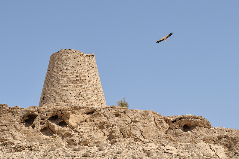
Jabal Bani Jabir Haffit beehive tombs
22°48’55.34″N – 59°03’17.74″E.
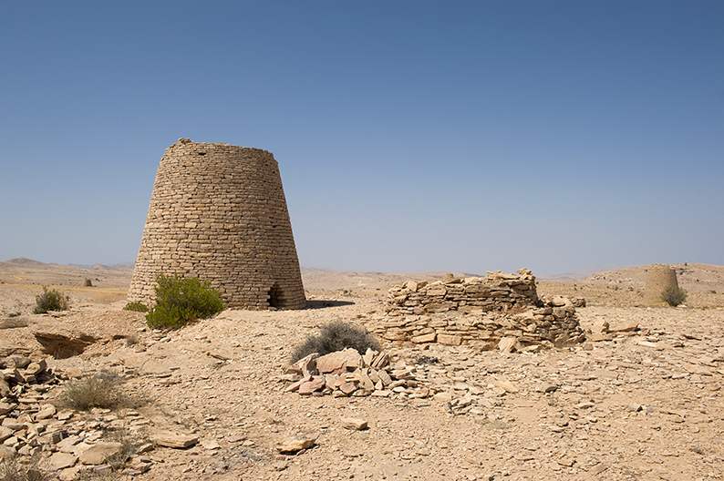
Let me first start by clarifying one thing. Even though it has been agreed to consider those monuments tombs, we actually have no evidence whatsoever they ever were. Indeed, no bones or other fragments have been found in any of them. Here or anywhere else in Oman. It is only because they remotely resemble in shape the Hili tombs found in Al Ayn in the UAE, that we assumed they were related in concept. While those of Hili were of a later date, were larger, had several entrances, multiple inside chambers, the ones you now see, are just plain silos. As such it would be better to admit that we have no idea yet what those structures are, instead of reaching to hasty conclusions we can’t back with any facts.
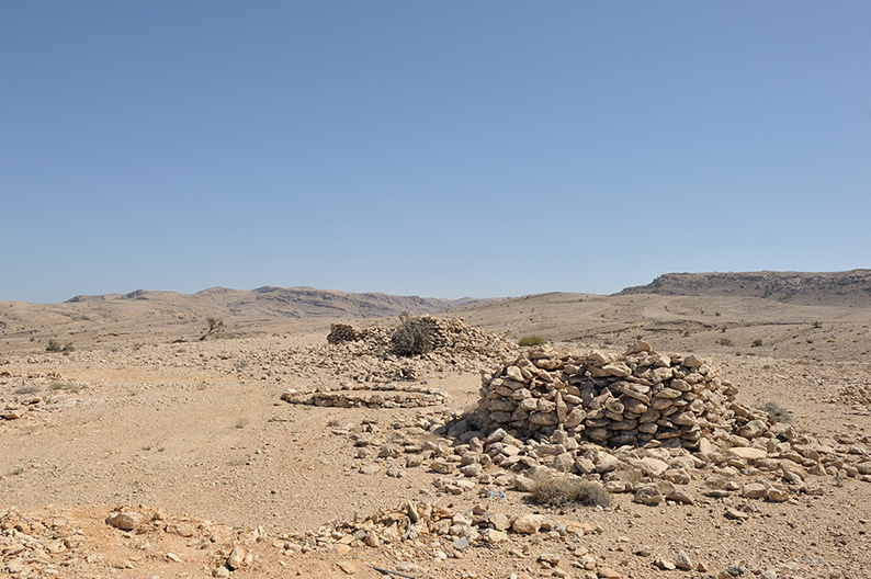
As such, there isn’t much I can’t tell you about them, beside the fact that it is stunning how such simple structures, made by pilling up surrounding flat stones on top of another some 5.000 years ago, still stand today in front of us. It shows us how, during what we call the Hafit period, roughly the early stages of the Arabian bronze age (3.100 to 2.700 BC), people lived and prospered in this desolated landscape.
It brings out so many questions we have no answers for. How did those people live ? Since we can see no houses or related structures around, where those their shelters ? What did they survive on ? How come we have found no remains, not only in what we pretend to be necropolis, but also in the surrounding area ? Etc, etc…
When I was here I had the chance to be greeted by a large group of Egyptian vultures circling around the “tombs”. I wish you the same luck.
Once done with the visit, get back on the track on carry on forward.
22°48’49.24″N – 59°04’02.17″E.
At the Junction take left.
22°49’37.80″N – 59°05’11.93″E.
At the Junction take left.
22°50’24.77″N – 59°05’01.13″E.
At the Junction take right.
22°51’32.55″N – 59°06’01.47″E.
At the Junction take right. Same for the next intersection 100 meter away. You’re now entering the Salmah plateau, for the second attraction of the day, the Majlis Al Jinn Cave. Now unless you have with you the proper equipment to go down the cave’s various entrances, you’ll be very disappointed by the cave, as you pretty much can’t see a thing from ground level. Just finding the cave entrances without a GPS is very hard.
If you have the right equipment and know how to use it safely, then you’re in for a treat !
If not just drive on and stay on the main track.
The Majlis Al Jinn Cave. – The meeting room of the spirits.
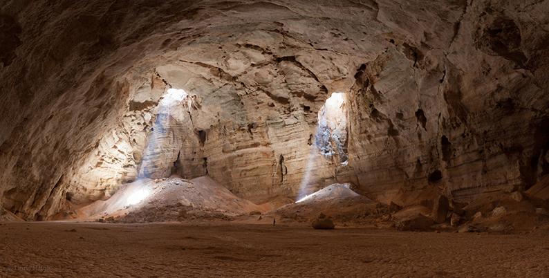
This cave is the second largest known cave chamber in the world, and largest in Arabia. It was discovered in 1983 by hydrogeologists Don Davidson and his wife Cheryl Jones while on the lookout for underground water in the area, and trying to understand how it behaves in this porous limestone environment. Located on the Salmah plateau at 1.380 meters above sea level, it is a single chamber cave of roughly 340 meters long x 228 meters wide with a ceiling of 120 meters. Early research on the cave showed that the early formation started some 40.000 years ago, when the area was going through a much wetter period, called “pluvial”. At the time acidic water carving through the limestone began the long process we can witness today.
“Majlis al-Jinn was formed in limestone of the Dammam Formation, laid down in a warm shallow sea 40 to 50 million years ago, during the Middle Eocene geologic epoch. Many millions of years later, compressional forces associated with continental drift folded, faulted, fractured and gradually forced the bedrock above sea level, when the chamber started to form.” Don Davidson
Now, as monumental as it looks today, we have no real sense of how deep it really is below the dry mud layer sitting at the bottom. This layer is the dry bed of an underground shallow lake which fills up during rain storms when runoffs spill inside the cave, before the water is slowly filtered through the mud and underneath limestone. It is believed that there used to be clear exits for the water to run off, but those where filled or blocked over time by debris and sediments, trapping the water in and creating the occasional lake. It is not too far fetch either to think that underneath that mud could possibly lay remnants of plants and animals from many many years ago, giving us a better understanding of the flora and fauna that lived here when the climates where more hospitable.
What used to be a very difficult and isolated area to reach, surrounded only by sparse herding camps, with local shepherds convinced that only spirits could hunt those dark spaces, which explains the name the explorers gave it once discovered (and which could also explain the various animal carcases found at the bottom, sacrificed ? – just my thought) is now far easier to reach thanks to new well maintained trails. With the necessary experience and the right gears it is a wonderful place to explore.
Here are the three main entrances, located as follow:
22°52’04.07″N – 59°06’17.39″E.
22°51’33.23″N – 59°06’59.16″E.
22°52’51.05″N – 59°06’16.67″E.
The last one being the most spectacular one. If you decide to go explore you can set up your camp for the night on the plateau. The first point listed above being the most isolated spot away from the village of Salmah. It’s also called the Cheryl’s drop because it was here that Cheryl Jones who discovered the cave with Husband Don Davidson descended for the first time.
If you can’t go down and explore, just keep going on the main track.
22°52’57.59″N – 59°07’27.41″E.
Caution. You’re about to enter a very very steep descent. Engage in 4-wheel-drive Low, but get back to normal when taking the sharp turns. Enjoy !!
22°53’43.66″N – 59°08’39.35″E.
If you didn’t explore the cave and still have time on your hand before reaching the beach, you can take right and drive down towards the bottom of Wadi Fins. There is a “parking”. Leave your car and go for a walk. Then come back up to this point and drive down.
As you drive down towards the beach, you will pass a few houses along the way. As this road is taken by tourists going up to see the cave and the tombs, local kids like to run for the cars and ask for water, chips and candies. Be generous.
Stay on the main track down toward the beach as the track turns to tarmac, passes underneath the Highway 17 and ends at a T-Junction with the same road you left this morning. 22°55’22.00″N – 59°12’40.38″E. On your left is the village of Fins. Not much there to see but they have a small food stuff store. Take right if you don’t need to go there.
Drive down the coast and look for a place to camp. 22°53’40.75″N – 59°13’19.88″E. is our recommended spot. Either on the sand or on the small cliff above. Again can be very popular on week-ends, try to find the best spots in the area.
This is the end of day two on the trail.
Day Three
Fins to Tiwi
38 km.
Introduction.
Today is not a driving day, but a trekking day where we will explore two of the most beautiful wadii in Oman, Wadi Shab and Wadi Tiwi, before coming back to camp on the same spot.
Recommendations.
To explore those two wadii you need a good pair of walking shoes and clothes that can get wet and dry easily as you will have to cross pools of water to progress through. Take your time and enjoy the day.
The drive.
22°53’40.75″N – 59°13’19.88″E.
As you leave the campsite on the beach and get back on the beach track head south. Follow this main track as it takes you towards Highway 17. Pass underneath the Highway and turn right towards the Highway entrance. Get on the Highway, direction Sur.
22°50’48.09″N – 59°14’18.80″E.
Exit the Highway, pass over it on the bridge and the follow the road as it takes you to the village of Tiwi. After crossing over the wadi, turn right towards the wadi, until you reach the parking right below the Highway bridge.
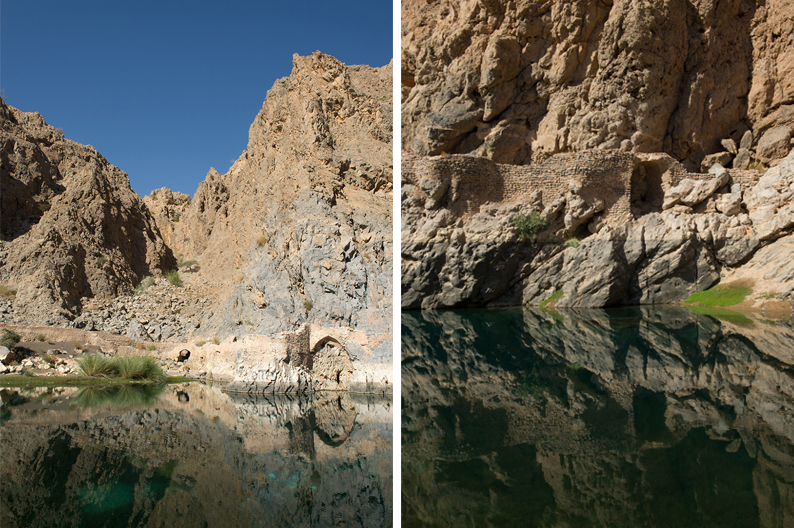
Wadi Shab.
Park your car. You are now at the entrance of beautiful wadi Shab. You can have breakfast at the little coffee shop if you’d like. You then need to get on the rowing boats across the pond if the water level is high (price 1 Rial per person). From there you can hike and swim through, the main attractions being the clear water pools and the waterfall in one of the caves which stands about 45 minutes away.
This wadi is a very popular attraction being so easily accessible and still fairly close to Muscat. It is on every tour operator’s list of places to see. As such it can be busy. But most people don’t go very far in, most stopping when you must get wet to pass through the first pools. It gets far less crowded after that and the further in you go.
To reach the cave and its waterfall, you have to swim through. Depending on the water level you may have to dive to pass through. Once in you have ropes installed you can use to climb up and dive in the pool.
Enjoy the swim, be safe, and take your trash with you, which should be understood by all, but unfortunately isn’t !
Once you are back in your car, leave the parking to back back on the road. Turn right.
22°50’09.66″N – 59°14’57.43″E.
As you cross through Tiwi, you’ll see a market for you to refill on supplies. It’s a decent size shop for this type of village.
22°50’01.53″N – 59°15’05.33″E.
At the Y-Junction take right, and stay on the main road heading south.
22°49’32.57″N – 59°15’38.39″E.
At the Y-Junction, keep right.
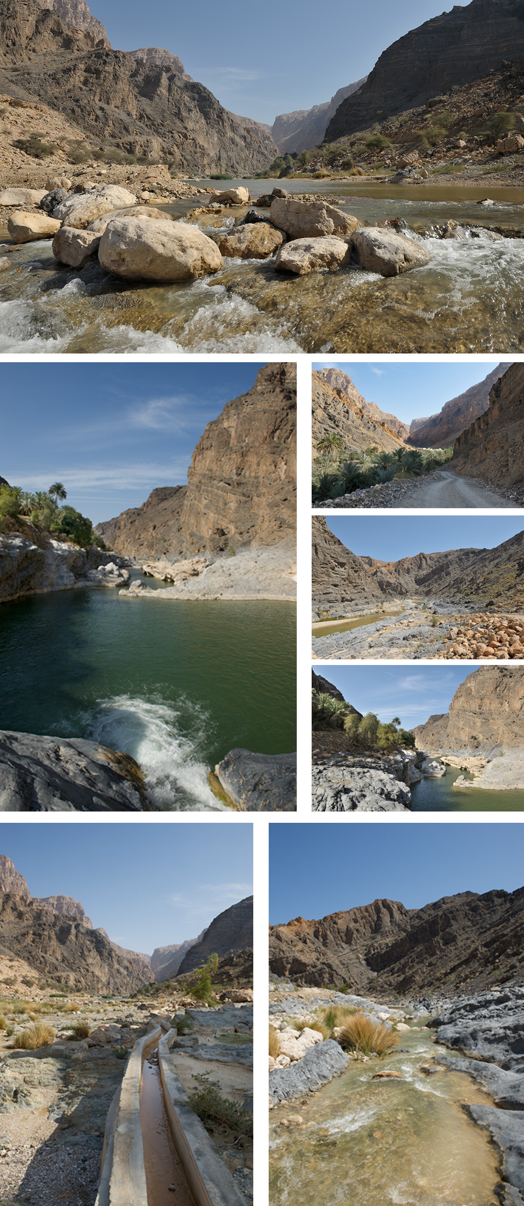
Wadi Tiwi.
The road will pass underneath Highway 17 and enter wadi Tiwi. Keep driving all the way through, passing villages and plantations. (at times the drives gets tricky – narrow streets, steep portions, etc)
When you feel you can’t go any further, park your car so you don’t bother local villagers and start your trek up or down the wadi.
For info I parked at 22°46’17.25″N – 59°12’50.86″E. Which is by Mibam. You can’t go any further by car. The main attraction of the wadi, its waterfall, is right below, but a bit challenging to reach. Once down, go either up stream or down stream.
Wadi Tiwi is not as busy as wadi Shab, because its exploration is more technical and requires more physical endurance. (Nothing too hard nevertheless) However, just like wadi Shab, you’ll need to hike and swim your way through.
Once you’re done exploring, get back in your car and drive back to last night campsite for a second night on the beach.
This is the end of day three on the trail.
Day Four
Tiwi to the Wahiba sands
190 km.
Introduction.
This is your last day in the oriental portion of the Al Hajar mountains. In the morning you’ll visit the ruins of the ancient city of Qhalat, climb back to the top of the mountains to cross over towards Wadi Bani Khalid and its pools for another great trek, before reaching the Wahiba desert for your first night in the dunes.
Recommendations.
Today is an amazing driving experience. There is no gas station until the end of the day, nor any place to get food. Make sure to be covered before climbing up. At time you’ll be far from it all with no phone coverage. A satellite phone is highly recommended.
You will need to engage in 4-Wheel-drive today, you may even need to use the Low range. Your tires should still be deflated to 20/25 PSI after you leave the Highway 17 portion.
The drive.
22°53’40.75″N – 59°13’19.88″E.
As you leave the campsite on the beach and get back on the beach track head south. Follow this main track as it takes you towards Highway 17. Pass underneath the Highway and turn right towards the Highway entrance. Get on the Highway, direction Sur.
22°42’24.40″N – 59°21’31.40″E.
Exit Highway 17, pass over it and follow the main road towards Qalhat, as it goes around the village and follows the Wadi up.
22°41’52.34″N – 59°22’11.84″E.
Turn left and cross the wadi, then climb up to the plateau to see the ruins of the old Qalhat.
Qalhat.
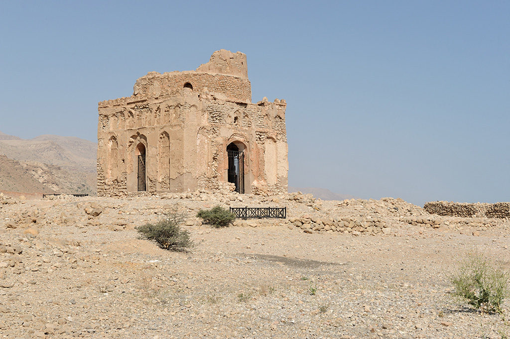
When I went the site was closed for archeological research. Yet, if you ask nicely the guard on site, he will let you in. (Being polite I went to ask first if I could enter, others didn’t bother and just went in anyway) This area being of major touristic interest, I can’t imagine it being close like this for ever, and you might not see anyone restricting its access by the time you go.
It is hard to imagine by looking at what is left of Qalhat, that it used to be a splendid ancestral city, visited and described in eloquent terms by such figures as Ibn Battuta or Marco Polo. First erected by Persians around the II° century, the town had reached its peak by the XII° century, where it was known as an influent harbor full of ships coming and going as far as India and China, exchanging horses and dates for exotic goods. All came to an end with the arrival of the Portuguese, and Albuquerque, (again!), destroying the town in 1508.
What you are looking at on that small plateau overlooking the Indian Ocean are the remnants of what was a beautiful mosque build by the Persians, and named after a saint Bibi Miriam. It was then surrounded by fortified walls protecting houses and shops, supplied with fresh water by a sophisticated falaj system coming down from the mountains.
Back on the main track, pass underneath the Highway and start the climb up (It is the proper time to deflate your tires) .
22°41’00.57″N – 59°19’29.00″E.
At the Y-Junction keep right. The track on the left is going down towards a village.
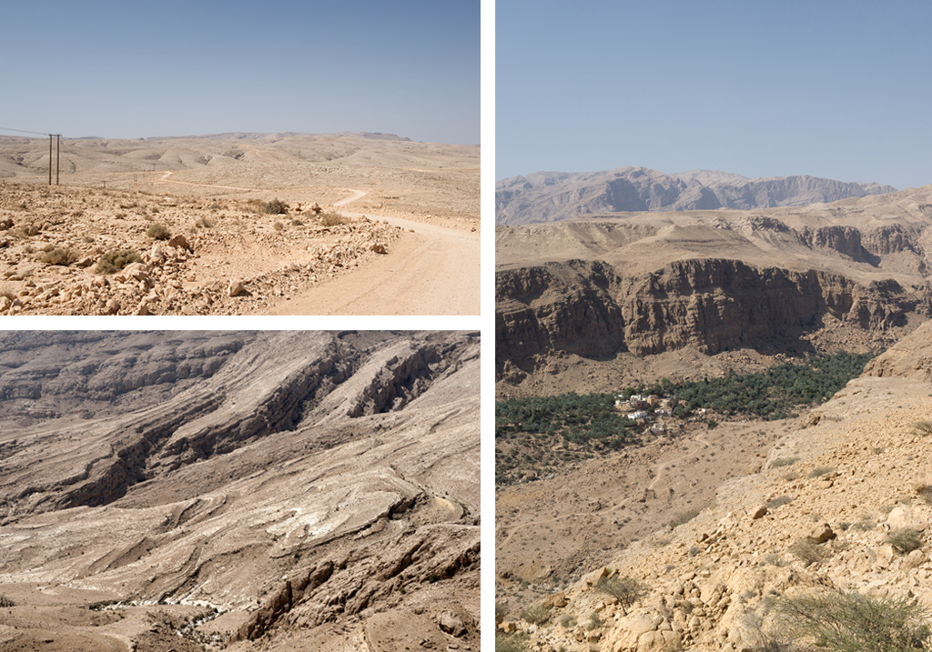
If you take the time to observe the landscape you will notice how tortuous some stone formations are, revealing the forces at play during the formation of the Al Hajar Ash Sharqi.
22°42’36.65″N – 59°14’49.36″E.
Stay left on the main track.
22°43’09.12″N – 59°13’06.14″E.
At the junction take left.
22°42’37.07″N – 59°09’31.56″E.
Stay left on the main track.
22°42’21.92″N – 59°08’34.65″E.
Keep straight on the main track.
22°44’54.83″N – 59°06’09.65″E.
Stay left on the main track trough the wadi.
22°46’44.10″N – 59°03’06.61″E.
Take Left.
22°45’57.88″N – 59°01’54.24″E.
Pass around the Hamlet following the track on the right and climb back up. Passing through the wadi be careful with the rocks. Then choose your gear accordingly, High or Low to tackle the steep rocky climb on the other side.
22°45’40.58″N – 59°01’16.08″E.
Stay right on the main track and keep climbing.
22°45’44.51″N – 58°59’35.00″E.
Time now to go back down. Drive with caution.
22°45’53.69″N – 58°58’49.81″E.
Stay left on the main track.
22°46’05.84″N – 58°58’12.54″E.
Stay left on the main track.
22°46’22.01″N – 58°57’39.55″E.
Take left on the main track. Then cross through the village and keep straight.
22°46’46.23″N – 58°56’40.08″E.
Take left, and left.
22°45’53.32″N – 58°56’14.61″E.
Keep straight.
22°45’48.00″N – 58°55’52.26″E.
Turn Left.
22°43’01.50″N – 58°56’41.90″E.
Stay on the center track, towards the tarmac road in front, and stay straight on it through the village.
22°41’31.22″N – 58°57’08.67″E.
At the T-Junction turn right.
22°40’41.93″N – 58°55’56.14″E.
Turn left.
22°40’32.00″N – 58°56’11.40″E.
Turn right.
22°40’25.48″N – 58°56’11.00″E.
Take the dirt track on the left of the tarmac road, and keep straight on the main obvious track.
22°38’52.60″N – 58°57’23.70″E.
Keep straight.
22°34’15.33″N – 59°01’51.60″E.
As you arrive in the Hamlet, take right and follow the main road You’re going to be on tarmac for a little while you can reflate to normal now or decide to drive safely with your deflated tires. You will have to deflate to 15 PSI later when you enter the desert).
22°33’46.60″N – 59°02’00.95″E.
At the road, take left and drive all the way to Wadi Bani Khalid.
22°34’16.79″N – 59°05’53.51″E.
Keep straight. Instead of following the signs leading you to the main pool, where all the crowd goes, it is best to keep straight and reach the lower part of Wadi Bani Khalid, called Al Hayer, where you’ll find less people.
22°34’09.99″N – 59°06’07.05″E.
Do not cross the wadi bed, instead take right and keep driving on the main tarmac road till 22°33’02.02″N – 59°07’05.05″E. where you can park your car and go explore the wadi.
Wadi Bani Khalid.
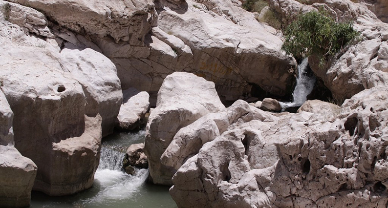
For many, this Wadi is the best in Oman. I could argue that it has a lot to do with the arrangements for picnics and barbecues build around the main pool area, which attracts tourists and families alike for a day at the pool. But that popularity tends to be its downfall. On weekends it can be so over crowded it looses all its charm. Now when it comes to trekking, the lower part of the Wadi leading to the village of Sayq is much more interesting.
You don’t have to do the full trek, after all you just did Shab and/or Tiwi and it tends to be very similar. However I recommend you go for a little walk to admire the first pools and the beauty of the rocks surrounding you.
Once you are done, just get back the way you came and drive all the way to the town of Al Bidiya. Signs will guide you, but in a nutshell, take the main road you came on all the way to Road 23, and turn left towards Al Bidiya. There you’ll find food stores and gas stations.
22°27’17.07″N – 58°48’27.00″E.
You’re now in Al Bidiya, refill your gas tank here as you’re about to enter the desert. There will be no other stations for quite a while. It is strongly advised to carry extra fuel for safety.
Out of the gas station go backwards on road 23.
22°27’07.96″N – 59°48’40.23″E.
Turn right, and follow the tree cladded road all the way to the al Muntarib castle.
22°26’01.46″N – 59°48’01.48″E.
Al Muntarib Castle.
(Open from Sunday to Thrusday from 7:30 am to 2:30 pm) Said to be one of the oldest fort in the area, build by Imam A’zzan bin Qais al Busaidi in 1587-88 to protect and defend the fertile oasis of Al Muntrab on the edge of the Wahibah sands, and restored by the government 1989.
This is all the information I could find, if anyone has more, feel free to share.
After the castle turn left, and follow this route.
22°25’12.14″N – 58°47’11.75″E.
Turn right.
22°25’12.43″N – 58°47’05.55″E.
Turn Left.
22°25’12.14″N – 58°47’11.75″E.
Turn right, and keep straight all the way as you enter the desert. This track will lead you to various Bedu camps. The last one being the 1001 nights camp. 22°06’05.00″N – 58°45’38.06″E. I don’t advise you to stay in those camps, you are much better off camping in the dunes on your own. Just look for a place far enough from the track and the established camps to avoid the crowd and noise. Where you stop depends of the hour you enter the desert. If you have spend some time exploring wadi Bani Khalid, and the castle, you should start looking for camp early on. If not just keep going until the sun goes down.
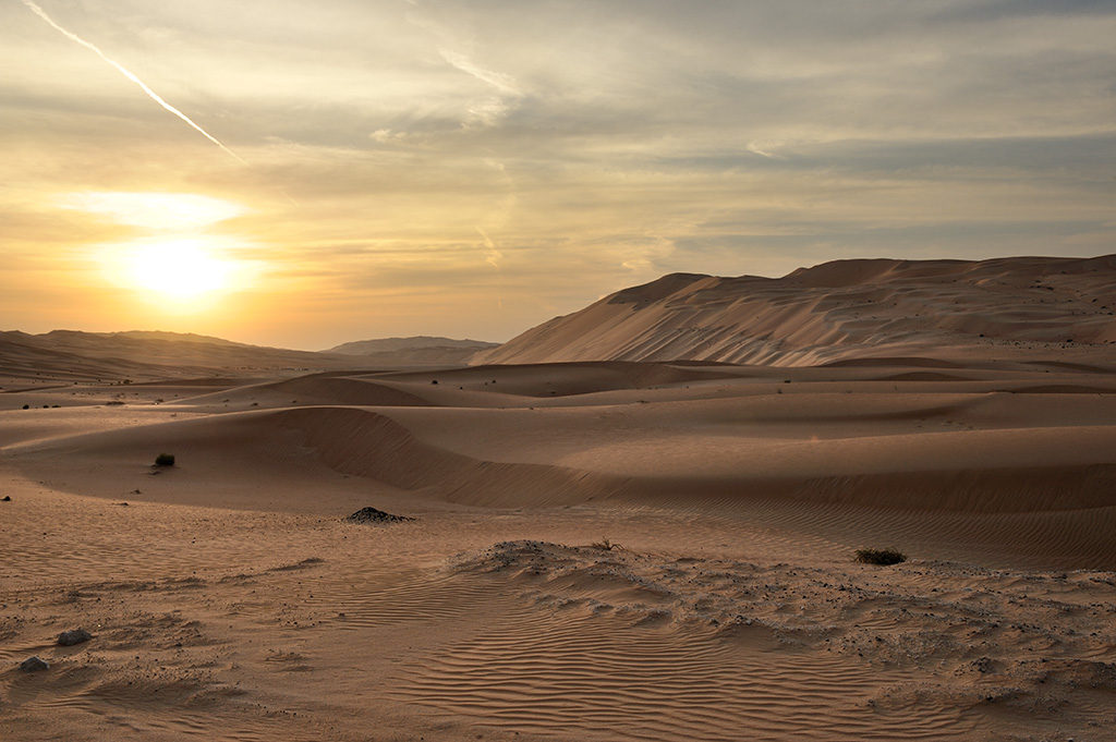
Regarding camp, the Wahibah is known for its wildlife. If lucky you’ll be allowed to see gazelles and oryx roaming free. It is also known for its insects, attracted by campfires. Just remember, they are more scared of you than the other way around. No point killing any creature for no reasons. Just don’t sleep on the ground outside a tent, that’s all.
This is the end of day four on the trail.
Day Five
The Wahiba sands to North of Ghalat
145 km.
Introduction.
Today you’ll be crossing your first desert of this trip, the Wahiba sands. Magnificent dunes running parallel to the ocean, offering spectacular views all the way to the beach. The desert is full of wildlife. However most of them will hide during the day, your best chance to spot them is early in the morning.
Recommendations.
It’s not that long of a drive. It’s meant to give time to explore the desert. Now, if alone I strongly recommend you stick to the main track. If in a convoy, then feel free to explore and enjoy the dunes. The track the way-points below indicate is a well established track. It even appears on maps as a “secondary road”. It represents no difficulties for anyone used to desert driving.
Again, at times you’ll be far from it all with no phone coverage. A satellite phone is highly recommended.
You will need to engage in 4-Wheel-drive today. Your tires should still be deflated to 15 PSI.
The drive.
The Wahiba sands.
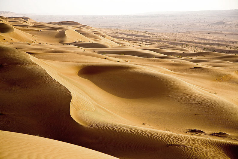
“I saw the sand dance to the rhythm of the wind”
To understand any desert you have to understand the winds. The Arabian peninsula is dominated by two prominent wind systems:
During winter, the Shamal, blows down from the Arabian gulf, before turning clockwise across the Rub al Khali. In the summer, the South-West Monsoon, coming from the Eastern Africa, crosses the Arabian sea on its way to India, while some of it branches upwards through the Wahiba sands on its way to the Al Hajar mountains. Those two systems are responsible for the dunes you see today. Those originated around the last regional glaciation of the late Quaternary some 20.000 years ago, and reflect the environmental variability of Oman. While the overall sea levels where low, sand was moved from the exposed grounds onto the Arabian peninsula by Monsoon winds. The sand was then stopped North by Wadi Batha, and West by Wadi Andam, were water coming down from the mountains was on its way to the ocean. The on and off aridity of those wadii explains how some dunes were later cut off from the main sand sea, and stand alone separated today.
When the sea level rose again, the sand supply was cut off. The wind however kept on moving the exposed sand remaining above sea level. It is why you can see the southern part of the desert around Baar al Hikman being left completely bare and feature less, all the sand having been blown away up North. It also explains why the dune of the North are far taller and bigger than the ones you’ll see further down South.
We know of two distinct sand accumulation periods, one before and one just after that last glaciation period. Beneath the desert surface lays an older cemented carbonate sand called Eolianite, some of which you can see further down as you will reach the coast of Oman. As you stand on the beach, you’ll see small cliffs of cemented sand. Those are the remnants of the first sand dunes.
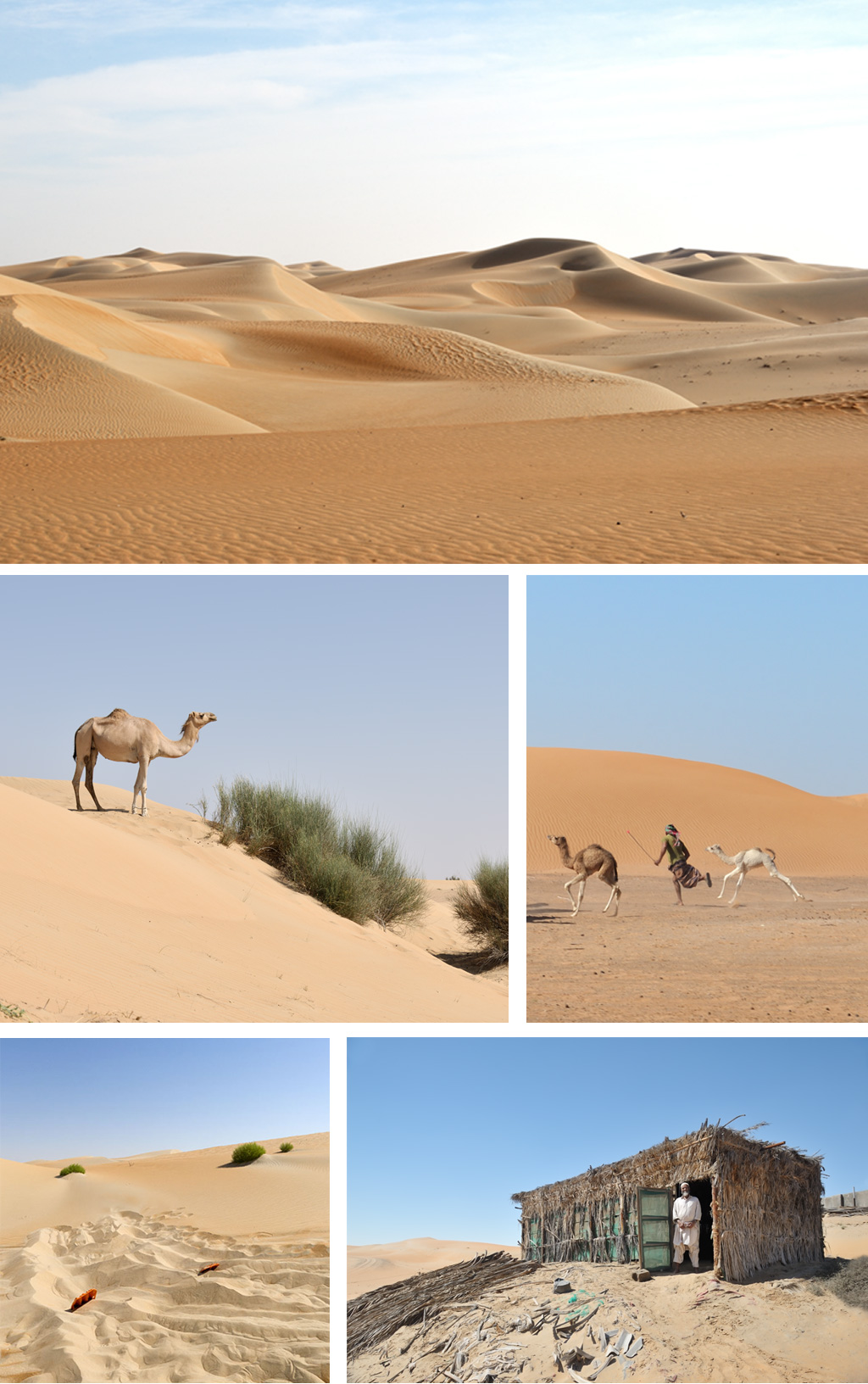
What appears empty at first glance is on the contrary full of life. This desert land is known for its abundant wildlife and flora. 150 different native plants being referenced as of today for example. It is also populated by bedu tribes such as the Bani Wahiba, the al Amr and the al Bu Isa, still leaving around the various oasis you can find throughout the sand dunes.
22°06’05.00″N – 58°45’38.06″E.
You’re on the main track, the 1001 nights camp sitting on your right, head south on the main track. As you follow those established tracks, here is the list of points you should pass to reach the beach. As you will see there are many tracks to follow in this desert, some coming and going based on regular traffic. To explain right left at each intersection would be like writing a book. Just aim for the listed points below, keep a south – south east direction and you’ll be just fine, and end up on the beach for camp.
Again you can decide to follow your own trace enjoying the feature less dunes. It is all up to you, depending on your driving skills and confidence.
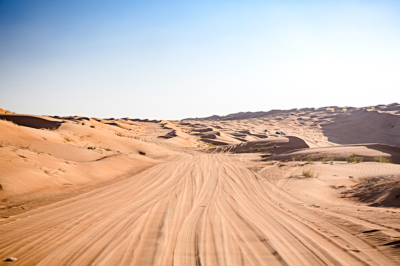
22°03’37.32″N – 58°45’59.42″E.
21°56’13.53″N – 58°45’31.79″E.
21°54’32.64″N – 58°45’28.15″E.
21°53’22.63″N – 58°45’46.34″E.
21°52’07.34″N – 58°45’47.56″E.
21°47’50.89″N – 58°45’33.44″E.
21°47’10.21″N – 58°45’52.89″E.
21°46’13.61″N – 58°46’06.68″E.
21°43’46.32″N – 58°46’17.12″E.
21°42’43.34″N – 58°46’26.67″E.
21°39’38.49″N – 58°46’55.34″E.
21°38’47.58″N – 58°47’14.47″E.
21°37’47.40″N – 58°47’57.30″E.
21°37’25.12″N – 58°48’29.32″E.
21°36’56.55″N – 58°48’29.84″E.
21°36’30.00″N – 58°48’54.26″E.
21°34’18.34″N – 58°49’05.65″E.
21°33’35.60″N – 58°49’05.05″E.
21°31’34.23″N – 58°50’16.36″E.
21°27’26.03″N – 58°52’23.32″E.
21°23’12.06″N – 58°54’16.13″E.
21°17’09.57″N – 58°54’53.74″E.
21°11’15.59″N – 58°55’44.78″E.
21°09’31.87″N – 58°56’03.01″E.
Cross the road and head on toward the beach for camp.
21°08’59.84″N – 58°55’59.79″E.
You’ve reached the beach, camp where you like.
This is the end of day five on the trail.
Day Six
Ghalat to the White Sugar Dunes
208 km.
Introduction.
Another excursion in the Wahibah sands, this time through more technical dunes, and the exploration of the Huqf volcanic range, before a night on the white sugar dunes.
Recommendations.
Today first section is more technical than yesterday’s. You’ll need to find your own trace. If alone and not sure of your sand driving skills, you may want to skip that part and follow on the road until the town of Masirah. After that nothing very complicated other that navigation in exploring the Huqf range.
Again, at times you’ll be far from it all with no phone coverage. A satellite phone is highly recommended.
You will need to engage in 4-Wheel-drive today. Your tires should still be deflated to 15 PSI for the first desert section, then get back to 20 PSI for the rest of the drive or stay at 15 to avoid trouble in the few sand sections.
The drive.
21°08’59.84″N – 58°55’59.79″E.
Leave the campsite and follow the shore heading south. Either drive on the beach, or find a visible track going in the right direction.
21°06’55.34″N – 58°53’40.74″E.
Time to leave the beach behind and get back to the dunes. Turn right and head north-west. You’ll cross the main road again and enter a nice but tricky set of dunes. Cross those until you reach the sand plains.
21°10’25.44″N – 58°50’10.98″E.
You’ve reach a sand plain. Head west towards the dune on the other side. Find your way through those until next way-points.
21°10’33.18″N – 58°44”53.16″E.
21°11’44.76″N – 58°41’02.64″E.
Nice needed shade under the trees.
21°12’12.66″N – 58°38’45.84″E.
You’ve reach a sand track. Turn left heading south and follow the track for a while then follow the dune ridge towards the next point.
21°01’11.64″N – 58°32’32.22.”E.
You’re now crossing a sand plain heading towards an isolated hamlet.
20°56’24.30″N – 58°28’41.64″E.
You’ve reach the hamlet, you’ll find the track heading south-southwest. Follow it.
20°53’04.38″N – 58°22’13.08″E.
At the track junction follow your track as it bends left. Follow it as it turns into a road.
20°45’39.02″N – 58°18’27.90″E.
You’ve reached the main road and the town of Al Masirah. Turn right and follow the road until you reach the gas station.
20°45’56.85″N – 58°17’08.53″E.
Refill again at this gas station, and keep straight on the Highway. (If you are still good with gas, there is a second gas station not too far off where you can stop before going back off-road.
20°52’41.81″N – 58°11’39.55″E.
Refill again at this gas station, and keep straight as you cross Highway 32.
20°53’21.03″N – 58°10’09.57″E.
Leave the road and enter the main dirt track on your left, going West. Stay on this main track.
The Huqf Range
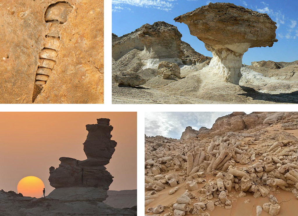
© Bottom left by Y-Oman the rest by kpn.nl
This range is actually called the Huqf (pronounced Hookfa) supergroup by geologist and can be divided in three groups split between 725 MA (Million Years) to 540 MA. the Abu Mahara group 725-645 MA, which saw two glacial successions in between of which shallow marine sedimentary rocks were formed. The Nafun group 645 – 547 MA where post glacial carbonates and silicilastics (rocks formed by the combination of other rock debris) covered the previous strata. The Ara Group 547 – 540 MA during which were deposited sub-surface carbonates, evaporites and organic rich shales and interbedded ashes. The latest explaining the numerous marine fossils and the dark colored stones visible today. To resume it in simpler terms, the various climatic episodes of the past, between glaciations and wet marine periods, had this area at times arid and other times submersed by water. The water shaped the stones you see today. The ice and glaciers marked the stones as they were moving across the area. The marine fossils were left behind as the water left. All of which makes this area a fantastic place to explore, and a journey where you should get out of the car often to take a closer look at the rocks around you.
20°54’21.69″N – 58°05’19.10″E.
Stay on the main track as it bends left.
20°53’30.97″N – 58°03’46.11″E.
At this double intersection, take left, and left again. And keep going on this main track.
20°50’58.04″N – 58°01’29.47″E.
Leave the main track and turn left (south) on the small fainted track. From here the tracks are not always easy to see, and you’ll have to make your own lines from time to time between the following way-points.
20°50’41.38″N – 58°01’24.87″E.
Stay on the main track on the right. As you can see there are too many traces in the dirt to mention. Just head south following the rocks ridge on your right till 20°47’30.35″N – 57°59’24.19″E were you can cross-over. Once on the other side, just follow down the main track, following the new rock ridge on your right.
20°37’49.21″N – 57°57’38.75″E.
From here take right south-southwest to get closer the Qarn Aswad (black rocks) on your right.
20°34’38.88″N – 57°54’12.19″E.
From here find a lane between the rocks on your right and the small sand dunes on your left, until your reach the vegetation where you’ll pass trough some small dunes, and keep heading in that same direction along the edge of the rocks. There is a more “obvious” track 20°34’11.05″N – 57°53’41.12″E that will lead you to a small farm.
20°31’57.12″N – 57°53’20.73″E.
On your right is a small farm. keep going straight on the track. Stay in that same direction when the track fades, as it will become more obvious again down the line.
20°31’00.11″N – 57°53’06.84″E.
Follow the faint track south as it bends between rocks and sands.
20°30’06.31″N – 57°52’58.81″E.
As you zig zag between rocks, here is your best option to cross this rock output in front of you. Once on the other side the track splits in two, kept right, and drive down all the way to the Highway 32.
20°28’35.04″N – 57°52’52.20″E.
You have reached the Highway. Turn left, get on it and head North for just a few hundred meters.
20°28’59.94″N – 57°53’29.23″E.
Leave the road and get on the faint track.
20°28’55.48″N – 57°53’47.22″E.
The track crosses the sand wadi, leading you to a small fishing hamlet. Keep in the same direction as you pass the village from the left.
20°28’40.47″N – 57°57’19.49″E.
Follow the faint track as it follows the wadi and takes you through the rocks towards the beach.
20°26’00.51″N – 57°59’37.98″E.
Drive down the beach, pass the rocks until you reach the stunning white sand dunes. You can camp where ever you want and explore the dunes around you.
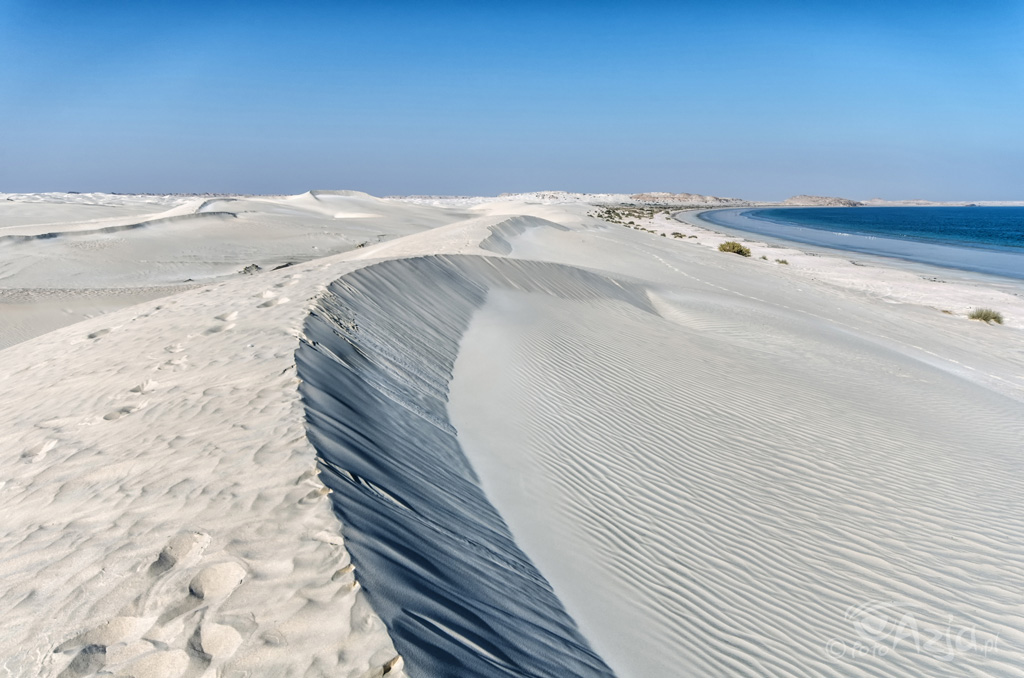
This is the end of day six on the trail.
Day Seven
The White Sugar Dunes to Ra’s Khashaim
272 km.
Introduction.
Another day exploration of the Huqf volcanic range, a short incursion inside the Wildlife reserve, a fantastic drive along the cliffs overlooking the Indian Ocean, and a look at the shores of Ra’s Madraka.
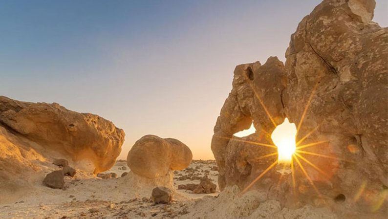
Recommendations.
Again nothing very technical or very complicated other that navigating through those stunning isolated locations.
Like before, at times you’ll be far from it all with no phone coverage. A satellite phone is highly recommended.
Your tires should still be deflated to 20 PSI.
The drive.
20°26’00.51″N – 57°59’37.98″E.
Leave the campsite and follow the shore heading south. Bend west before you reach the salt fields, and follow the faint track until it merges with the main one at 20°19’22.40″N – 57°53’21.48″E. Follow that new track all the back to Highway 32 at 20°20’39.93″N – 57°46’57.74″E. Get on the Highway and head south.
20°12’06.69″N – 57°43’56.25″E.
Gas station.
20°09’01.02″N – 57°43’28.10″E.
Get off the Highway and turn right on the dirt track heading towards the rocks.
20°08’52.02″N – 57°41’46.43″E.
As the track nearly reaches the small farm, take the small fainted track on your left towards the wadi. At times you’ll need to make your own line between the rock formations until you reach the open plain.
Once in the open head south-southwest towards the black rocks. You need to find way-point 20°04’54.62″N – 57°35’42.18″E. where various traces merge into a track leading through the rocks. Just follow that track as you go around the outskirts of the wildlife reserve.
20°02’36.53″N – 57°35’13.59″E.
Leave the fence and follow the tracks as it bends left heading south. Follow the tire marks and make your own when needed.
19°59’50.60″N – 57°35’41.72″E.
Various tracks now join into a main one as it travels through the rock formations to reach a small sandy plain on the other side. Once on the sand plain, follow that same track as it leads you through the various arms of the wadi.
19°58’07.55″N – 57°35’53.46″E.
Keep heading south through the rocks on this track.
19°57’24.73″N – 57°36’08.96″E.
As you exit the rocks bend right towards the oasis at 19°55’43.10″N – 57°35’25.26″E. Slow down as you approach the water not too scare off potential animals.
Drive around the two main water holes and follow the tire marks as they lead to the natural reserve gate.
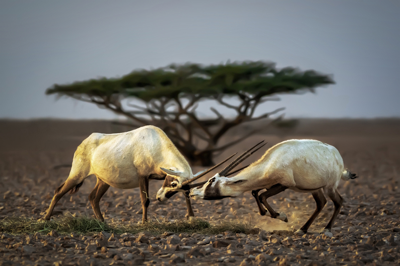
19°54’47.65″N – 57°35’54.20″E.
You’re now entering the natural reserve. From there head south-southwest towards the end of the plain trying to get as close as possible from the rock formation on your left.
19°49’00.50″N – 57°32’47.25″E.
At the end of the plain you’ll see a track taking through the rocks. Follow it.
19°45’47.50″N – 57°34’13.00″E.
You’re now leaving the natural reserve. Keep south until you cross a large dirt track.
19°45’09.85″N – 57°34’42.31″E.
Follow the main track going south-southwest towards the beautiful rock formation in front of you. At the foot of the mount, take left on the crossing track, and head south.
19°40’03.21″N – 57°37’56.15″E.
Take left on the road, then right on Highway 32 towards Dumq were you can get food and gas. You can reflate your tires to normal here.
19°37’34.26″N – 57°38’05.12″E.
Gas station and market. (There is a second gas station further along down the road.) Once done, get back on the road and keep heading south on Highway 32.
19°31’03.56″N – 57°36’13.12″E.
At the round-about take the first exit right. You have a gas station here you can use if needed.
19°29’10.81″N – 57°34’46.44”E.
At the round-about take left.
19°29’00.80″N – 57°35’27.42″E.
At the round-about take right.
19°28’17.85″N – 57°35’20.19″E.
Leave the road for the track on the left heading east. (I didn’t deflate, it’s all up to you here) There will be many tracks around as well as construction trucks. This is an area under heavy development, just head East-South-East until you reach a bigger track heading East toward the ocean. Get on it and drive towards the ocean.
19°27’07.00″N – 57°42’21.81″E.
Leave the main track for the trace on your right. From now on you will follow the coast. Go as close as you can following the various traces on the ground or make you own.
19°06’06.72″N – 57°47’34.85″E.
Leave the coast line and go around the low wadi until you reach Highway 32 again. Once on the Highway head down south towards Ra’s Madrakah and its various beaches. Once done you’ll need to back track on the Highway.
19°01’22.91″N – 57°45’51.42″E.
Leave the Highway and enter the faint track on your left. It branches out at 10 o’clock. Follow that track. (I deflated here to 25 PSI)
18°57’07.24″N – 57°39’39.39″E.
Keep right.
18°57’15.75″N – 57°39’31.47″E.
Keep left.
18°57’37.97″N – 57°38’44.91″E.
Turn left at 90°. Follow the track all the way down to the beach. Once on the beach look for a place to camp. (Careful with the beach sand, deflate to 15 PSI if you don’t want to get stuck in sand) If it is still early, keep driving on the beach until it gets dark and then stop for camp. You’re on an endless beach front, known for its wildlife and birds, with several lagoons and shipwrecks along the way.
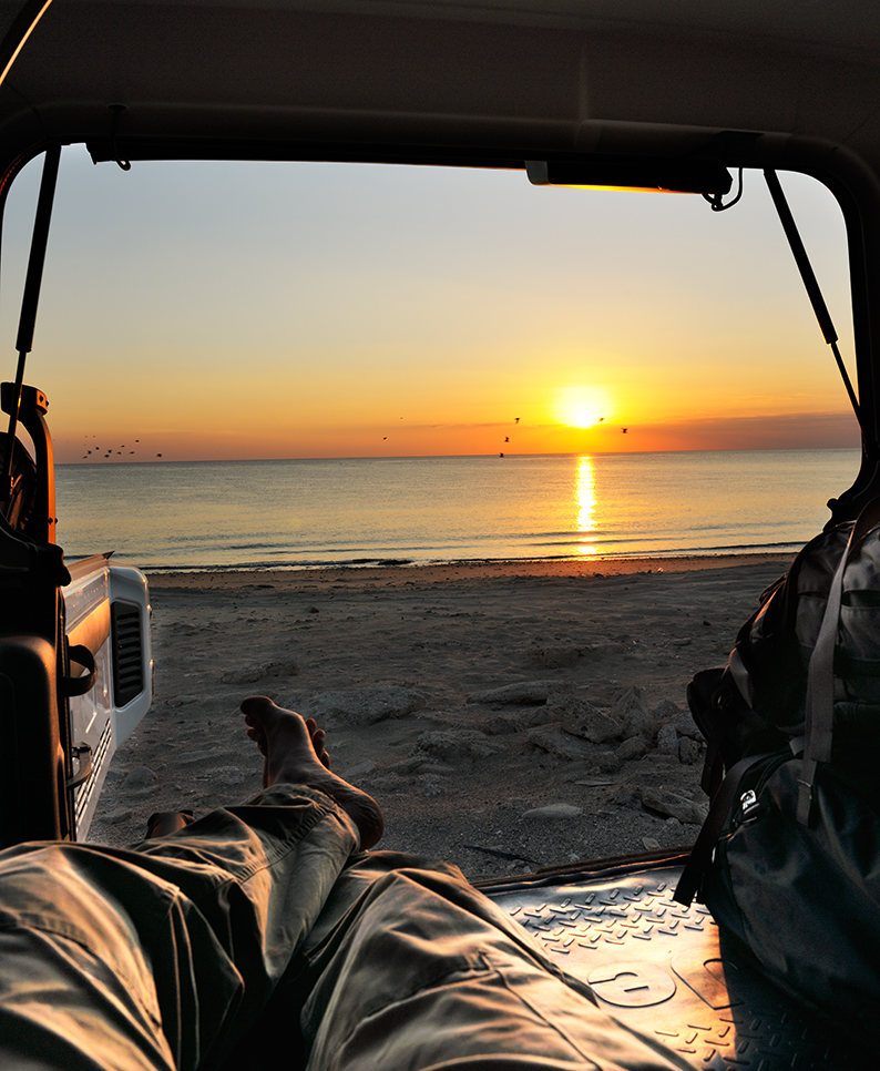
This is the end of day seven on the trail.
Day Eight
Ra’s Khashaim to Wadi Shuwaymiyah
346 km.
Introduction.
Leaving the flat shores for the Dofar mountains. After a long drive on the beach, with its fishermen, its lagoons, its wildlife and a few shipwrecks, you’ll get back on the Highway for a while until reaching the first elevations of the Dofar range. Ending your day on the edge of Wadi Shuwaymiyah for one of best campsites of the trip.
Recommendations.
Today can be considered as a transition stage with a bit of freeway time. Reflate to your normal pressure when reaching the freeway. Get down to 15 PSI while on the beach and set up for 20/25 when exploring the mountains.
Again, at times you’ll be far from it all with no phone coverage. A satellite phone is highly recommended.
The drive.
18°56’18.95″N – 57°38’09.11″E.
This way point is the first available campsite on the beach. You may have driven a lot further down the beach yesterday. Regardless of your position keep going on the beach. Either right on the edge of water where sand is harder or further back the shore on the various visible tracks. At times you may have to go around lagoons. They are a great place to observe birds, wildlife, and shipwrecks.
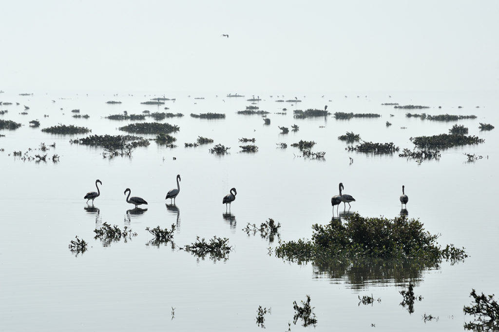
Go as far as you want or can along the beach. A good break up point is after the Al Kahil lagoon 18°35’18.42″N – 56°38’56.24″E. and it’s abandoned Dhow which makes for a great picture. Nothing stops you from staying on the beach but by now you have probably seen enough. If so, turn left to get back on the Highway 41 and keep on going south.
18°10’59.55″N – 57°32’40.77″E.
Stay on Highway 41 and head up the plateau. Drive on till the next way-point. (As explained above, you should get your tire pressure back to normal)
18°03’10.49″N – 56°15’23.02″E.
Turn left and drive down all the way toward the coast.
17°56’35.96″N – 56°15’30.59″E.
The trail turns here right following the coast. However, there is a gas station further down and a small fishing village straight on. This village is a good example of the hired fishermen’s living conditions.
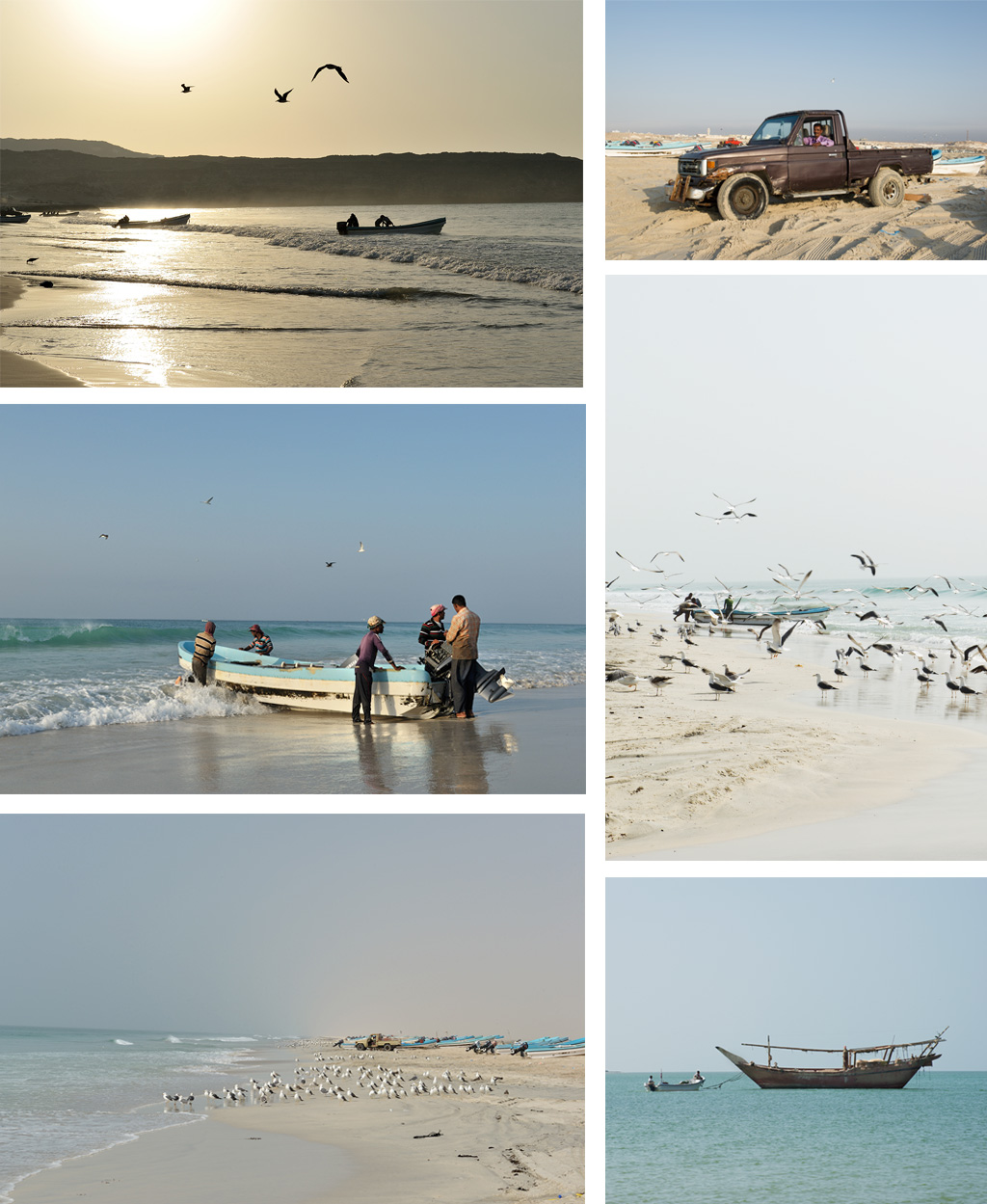
Once back on the trail just stay on the main track. (no point deflating here)
17°55’44.00″N – 56°08’43.16″E.
As you can see picnic areas have been spread on the shoreline. Depending on the time you can take left at the Y-Junction and stop for lunch here. If not take right as the track climbs back to the plateau. Stay on the main track all the way back to the Highway 41.
18°01’33.29″N – 56°02’13.41″E.
You’ve reach the highway. Take left.
18°06’59.55″N – 55°39’38.97″E.
A good gas station to fill-up with a small food stuff to get basic items. Once you’re done, get back on the Highway and turn left at the round about on Highway 42. Stay on this Highway till the next way-point.
17°57’55.20″N – 55°38’38.82″E.
Leave the Highway and turn right on the dirt track. This main track is taking you along the northern edge of wadi Ash Shuwamiyah. Just follow the main track. (Here it’s best to deflate again to 20/25 PSI)
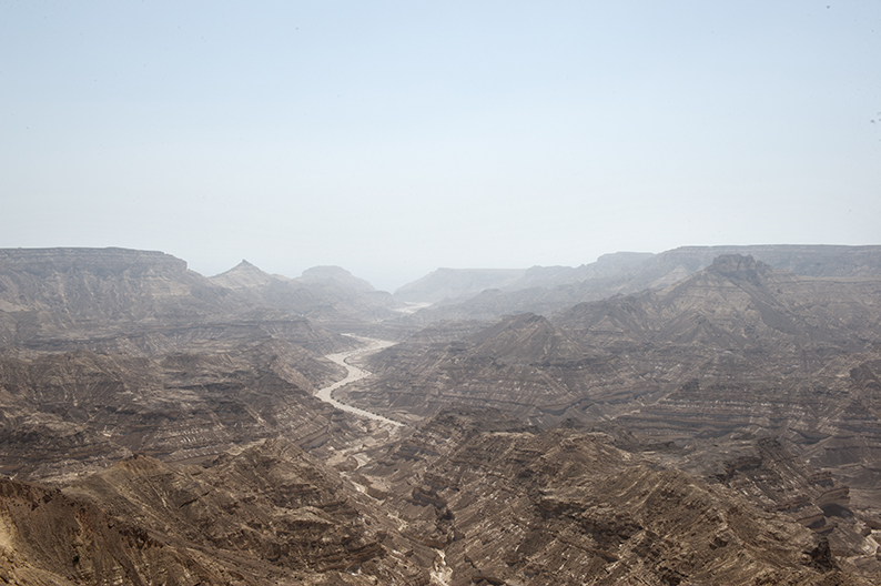
17°57’09.05″N – 55°27’17.62″E.
Leave the main track for the small track on your left, as it will take you across the small wadi and head south towards the edge of wadi Ash Shuwamiyah. Depending on the time you may want to stop here for the night and enjoy this incredible site. If too early to call it a day, go explore on foot the wadi below. A good way to access the bottom of the wadi is to drive back to where you just crossed by car further up, and walk from there.
17°55’03.89″N – 55°27’21.49″E.
Campsite.
This is the end of day eight on the trail.
Day Nine
Wadi Shuwaymiyah to Mirbat
234 km.
Introduction.
For the second day, you’ll be on tarmac quite a bit. But what a road ! Stop often on the beaches. The end of the day is spent off-road to reach another stunning campsite overlooking the Ocean.
Recommendations.
As mentioned above, most of today is on tarmac. Reflate to your normal pressure when reaching the freeway, and set up for 20/25 when exploring the mountains at the end.
Again, at times you’ll be far from it all with no phone coverage. A satellite phone is highly recommended.
You may encounter military checkpoints along the way. Have your passport, driving license and insurance for the car ready. Most of the time, soldiers do not speak english, but in my experience have always been friendly and happy to see you interested in visiting their country.
The drive.
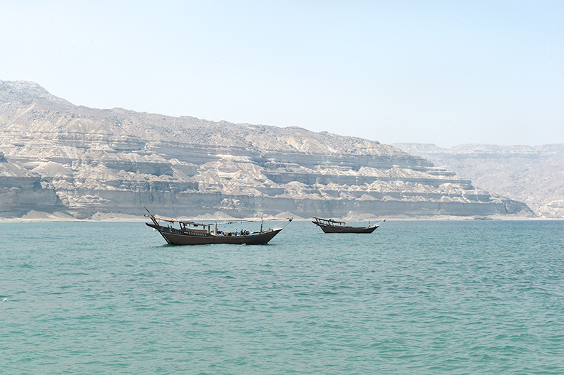
17°55’03.89″N – 55°27’21.49″E.
From this campsite, you need to find your trace and follow the edge of the wadi. There are faint tracks, but at times you’ll have to pretty much make your own, until all the faint tracks merge back into a more prominent trace at 17°53’42.11″N – 55°24’55.19″E and reach the lower plateau.
Once down the track heads again towards the edge of the cliff and follows it as it curves right.
17°53’52.99″N – 55°24’38.01″E.
The track brought you right on the edge of the cliff. Drive with caution around this edge. From here head West.
17°54’13.97″N – 55°22’48.93″E.
At this point you’ll see a more prominent track heading southwest. Take left on that track.
17°52’47.36″N – 55°19’20.35″E.
Cross the wadi bed and turn west right after it. In a few meters you’ll find a larger track. Take right on that track.
17°53’12.69″N – 55°17’30.03″E.
You connected back to the main track you were on yesterday before leaving for a campsite on the edge. Take left on that track and follow it all the way back to Highway 42.
17°51’58.22″N – 55°14’23.49″E.
At the junction keep straight.
17°44’55.71″N – 55°15’02.53″E.
At the T-Junction, keep straight on the main and obvious track all the way to Highway 42. Time to reflate your tires.
17°39’18.39″N – 55°15’22.05″E.
Take right on Highway 42. What comes next is a beautiful road along the coast. Stop as often as you can to admire the rocky beaches along the way.
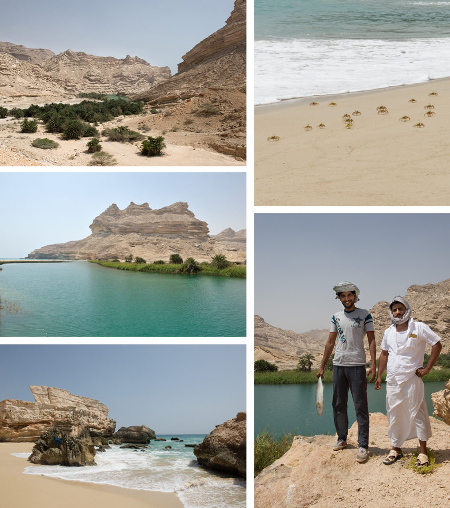
17°03’38.22″N – 55°04’53.02″E.
Leave the main Highway and take left on that road leading towards Sadah.
17°03’07.01″N – 55°04’16.41″E.
In Sadah take right and go straight across the village on that same road until it turns into a dirt track going up the hill. (Time to deflate to 20/25 PSI again)
17°04’15.89″N – 55°03’15.66″E.
At the Junction keep straight.
17°04’18.11″N – 55°02’29.54″E.
At the Y-Junction take left.
17°03’52.42″N – 55°02’01.16″E.
At the junction take left.
17°03’44.52″N – 55°01’57.23″E.
At the Y-Junction take right.
17°03’29.82″N – 55°01’36.07″E.
At the junction take left and enter the wadi bed.
17°02’35.83″N – 55°01’49.85″E.
At the wadi junction keep right.
17°02’56.71″N – 55°00’25.09″E.
At the junction keep right.
17°03’13.29″N – 54°59’04.86″E.
Leave the main track and turn left for the wadi track. This track follows the shore in zig zag fashion. Every track you’ll see on your left will take you to a cove (main ones at least), every track on your right will bring you back towards the Highway (again the main ones).
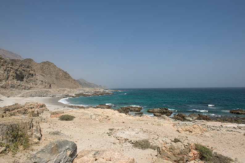
Now this main track will also pass in front of the two major beaches. It is up to you to decide where you want to camp from here on.
I recommend this one, 16°57’51.93″N – 54°51’45.46″E. But again I have not explored every single one of them to claim it’s the best option, as I’m sure you can find more seclude ones before. Your call.
This is the end of day nine on the trail.
Day Ten
Mirbat to Salalah
94 km.
Introduction.
This day is dedicated to the visit of Salalah and its surroundings. The mileage indicated does not take into account the various visits you have the liberty of undertaking today.
The town itself isn’t much to see. You can skip the souk, as it is way too tourist oriented. The Salalah museum (A’Nadhah Street, open Sat to Wed from 8am to 2pm – free). What is interesting in Salalah are it’s surroundings. Like Khor Rawri, which attracts a wide number of birds. You can also admire the fishes through the clear waters. Another popular natural attraction is Jabal Samhan & Tawi Atayr, (It’s only green with lush plants and boasting its waterfall during the summer) The cave is visible near the village of Tawi Atayr. Last what made the area famous is the Fankincense tree. You can see it in Wadi Dawkah North of Salalah.
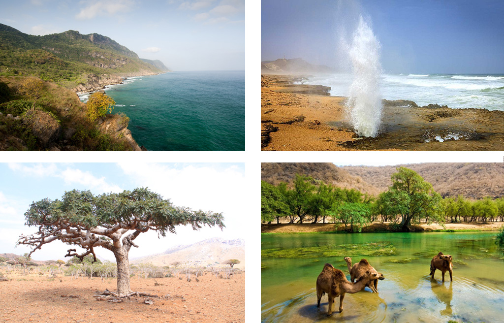
I didn’t take any pictures while in Salalah. The main reason was the weather that day. Also because every pictures you’ll see, like the ones I selected here, are shot during the summer. That is when the SW Monsoon wind brings rain to the region, and turns the arid landscape into greens. I came here during winter as you will as well. Simply because the rest of the trip is impossible to do during the summer. As such, everything in and around Salalah will be as arid as the rest of the trip.
© Picture at the top left by Khalid al Kharusi, bottom left by the Telegraph, other two unknown.
Recommendations.
Once back on the road, reflate to your normal pressure. Once in Salalah you’ll have many hotel choices. Like in Muscat you can decide to stay in a hotel or keep on camping. I camped on the beach 17°00’13.76″N – 54°07’50.41″E. and was very happy about it. But I understand that by now you might be dreaming about a nice bed and a warm shower.
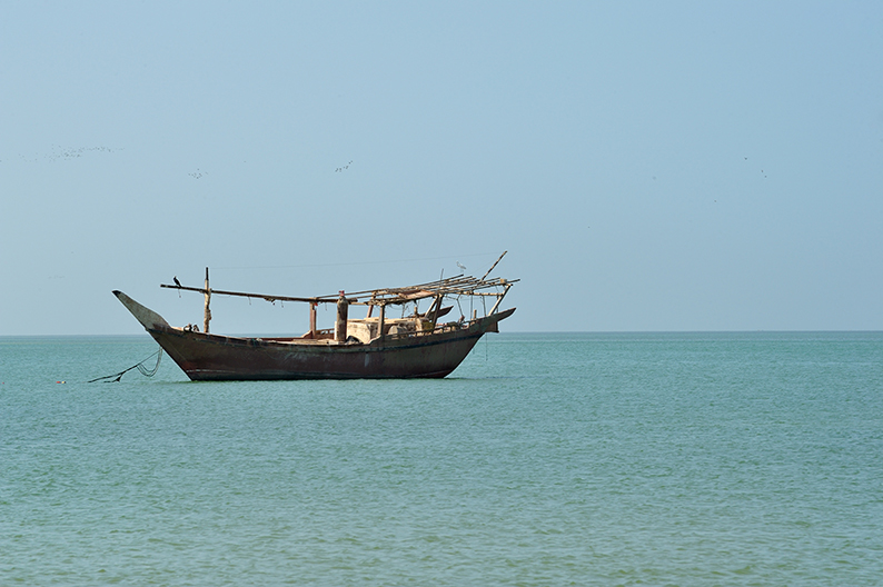
Check Booking.com for all your options. The Crowne Plaza Hotel is a fantastic choice (I camped next to it) and the Hilton, also on the beach.
Af far as food and markets, you’ll find all that you need in Salalah.
The drive.
16°57’51.93″N – 54°51’45.46″E.
From this campsite, Get back towards the main track you left last night and turn left. Stay on that track as it follows the coast all the way to Mirbat.
Mirbat is a small fishing village. Have a tour around, and once done head back towards Highway 49 and Salalah.
17°00’13.76″N – 54°07’50.41″E.
Campsite
This is the end of day ten on the trail.
Day Eleven
Salalah to Tawsinat
276 km.
Introduction.
The first part of the day is spent driving along the Dofar coast, before entering the stunning wadii along the Yemen border.
Recommendations.
The first 167 km are on Tarmac, offering again stunning views on the coast leading to Yemen. The second part is off-road again where you’ll need to deflate to 20/25 Psi. You will be passing two military checkpoints while in the wadii, but there maybe more as you are now very close to Yemen and the unfortunate events going on there.
The drive.
17°00’13.76″N – 54°07’50.41″E.
From the beach or the hotel you decided to clean up, get back on Highway 49 towards Yemen. The Highway will turn into Highway 47.
16°51’14.24″N – 53°24’06.78″E.
At the Junction turn right on Highway 45.
16°56’22.91″N – 53°22’32.40″E.
At the Junction turn left.
17°04’56.16″N – 52°59’07.72″E.
At last you are leaving tarmac and getting back on a trail. There is a military checkpoint. Just have your passport and car registration as well as your insurance ready.
Enter the main track as it follows the wadi bed going north. (Deflate to 20/25 PSI)
17°28’20.68″N – 53°00’01.81″E.
Time to leave the wadi bed and turn left unto the new track as it heads west.
17°23’22.29″N – 52°53’23.48″E.
At the Junction turn right.
17°23’39.93″N – 52°53’08.07″E.
This is your second Military checkpoint. Have all your documents ready. Once done head straight until you reach the large wadi bed, and turn right.
17°29’33.98″N – 52°50’32.96″E.
Follow the main track as it turns left onto the smaller wadi. Once you pass the small Hamlet called Tawsinat, it should be time for you to look for a place to camp.
17°35’29.27″N – 52°44’54.81″E.
This is our campsite for the night.
This is the end of day eleven on the trail.
Day Twelve
Tawsinat to Ar Rub Al Khali
312 km.
Introduction.
The first day in the Rub al Khali. Stunning dunes, a life changing experience.
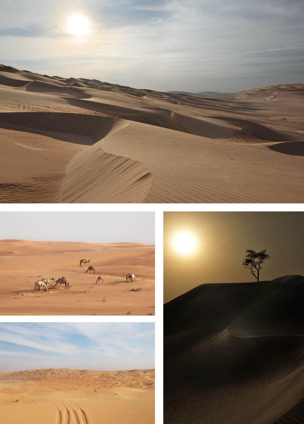
Recommendations.
We are following a well established track, mentioned on all Oman maps. Guiding you through a stunning isolated landscape. As mentioned in the introduction, due to the geo-political situation in the region there are many more military patrols in the area. Expect controls along the way and having to alter your route based on the patrol’s “recommendations”. That being said, this part is used by tour operators out of Salalah so you should be just fine.
Once in the sand lower you tire pressure to 15 PSI.
Again, at times you’ll be far from it all with no phone coverage. A satellite phone is vital here.
The drive.
17°35’29.27″N – 52°44’54.81″E.
From here, get back to the main track and head north until you reach the Highway at Al Mazyunah. This is the border post between Oman and Yemen. Turn right on the road as you don’t wont to get into Yemen, and follow the road.
17°51’59.80″N – 53°04’09.78″E.
At the Junction turn left and follow the track until you reach Highway 43.
18°17’25.44″N – 53°24’15.44″E.
At the junction take right towards U(n)bar – The lost city – and the last gas station for a long while. Fill up all that you can. Once done come back to this point and keep straight on that same track.
Follow that same track all day till you reach the campsite near the Oasis at 19°16’42.44″N – 51°19’37.83″E.
19°27’22.19″N – 53°19’50.79″E.
This spot is a good camping option. But there are many other around for you to decide.
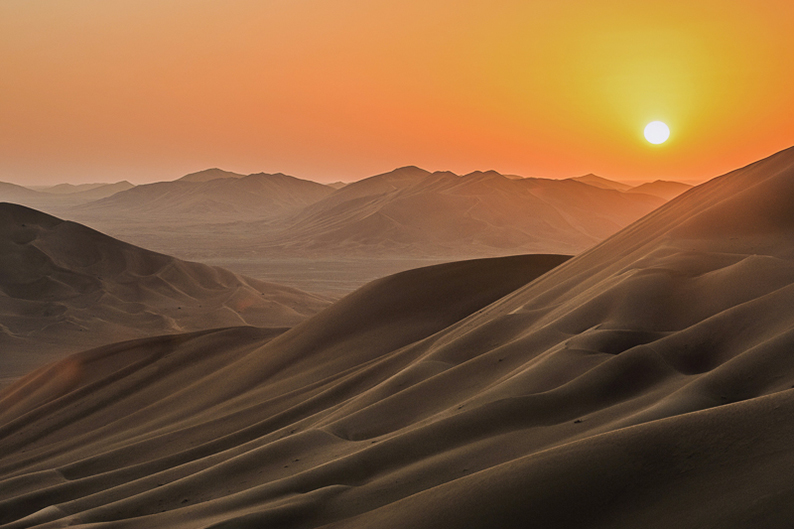
This is the end of day twelve on the trail.
Day Thirteen
Ar Rub Al Khali (Part Two)
378 km.
Introduction.
Second day in the Rub al Khali for more sand marvels.
Recommendations.
Today’s drive is more challenging than yesterday as the track starts to faint in some areas. You’ll also have to divert from your route to reach a gas station and refill.
Again, at times you’ll be far from it all with no phone coverage. A satellite phone is vital here.
Driving through this area alone is taking a lot of chances, and any military patrol finding you will immediately escort you out of the area.
The drive.
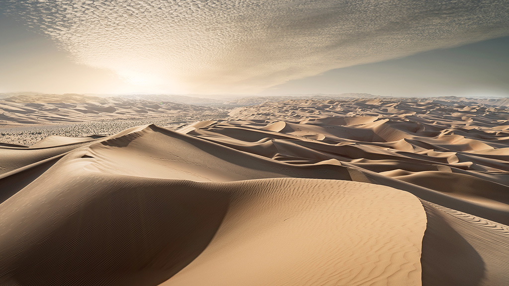
19°27’22.19″N – 53°19’50.79″E.
Once back at the Oasis, get back on yesterday’s track. It will start to faint as you progress, and at times while passing through dune sections you will have to make your own line. The idea is to pass from one flat sabkhah (plain) to the next using the lower dune sections separating them.
Here are the waypoints to guide you.
19°20’23.08″N – 53°22’17.48″E.
Dune – sabkhah edge.
19°21’59.47″N – 53°23’50.57″E.
Leave the track and take left, as you follow the dune formation.
19°23’13.35″N – 53°23’14.80″E.
Follow the track through the small dunes.
19°24’06.67″N – 53°23’30.95″E.
Follow the track through the small dunes.
19°25’42.06″N – 53°25’36.48″E.
Follow the faint track around the dunes.
19°25’36.04″N – 53°27’17.42″E.
Follow the track through the small dunes.
19°27’52.51″N – 53°30’36.25″E.
Follow the track.
19°28’26.51″N – 53°31’27.08″E.
Pass through the dunes and turn right once in the sabkhah.
19°28’36.18″N – 53°34’37.14″E.
Pass through the small dunes.
19°29’14.90″N – 53°35’53.81″E.
Pass through the small dunes.
19°29’33.43″N – 53°38’18.48″E.
Pass through the dunes.
19°29’38.59″N – 53°40’07.37″E.
As you enter the sabkhah, turn right and follow the dune line.
19°28’29.82″N – 53°42’04.33″E.
Pass through the dunes.
19°29’55.10″N – 53°44’15.64″E.
Pass through the small dunes.
19°30’05.76″N – 53°45’13.95″E.
The track becomes good again. Just follow it through.
19°32’50.24″N – 53°47’51.17″E.
Track junction. Turn right and follow that track. By turning left you would very soon cross into Saudi Arabia, which is not a good idea.
19°32’47.14″N – 53°52’40.11″E.
At the Y-Junction keep right.
19°31’50.19″N – 54°04’28.32″E.
At the Junction, take left.
19°34’14.03″N – 54°07’05.77″E.
At the Junction, keep straight. At the following T-Junction shortly after, turn right.
19°33’36.14″N – 54°10’44.93″E.
At the Junction, take left, and keep straight as you soon pass the buildings on your left. You’ll keep on that track till the next way point.
19°40’25.35″N – 54°30’07.83″E.
At the Junction, take left.
19°43’26.12″N – 54°36’05.65″E.
Keep on the track as you pass the buildings. Follow that track through the dunes all the way until it starts to faint.
19°54’22.68″N – 54°53’31.26″E.
From here you need to turn right and find your way through this dune section all the way to the main track that will take you back towards the Highway, where you can refill your tank and get food. The direction you are aiming for is 19°51’36.69″N – 55°02’12.46″E. Here turn right onto the main track as it passes the buildings on your left, and drive on.
19°37’19.52″N – 55°12’12.51″E.
Turn left on the Highway until you reach the gas station.
19°36’48.18″N – 55°31’01.46″E.
Gas Station. Fill up it all and get some food and water for the night. Turn around and back track on the Highway.
19°36’54.83″N – 55°19’44.52″E.
Leave the Highway and get on the track on your right heading north, heading for the following way-points.
19°48’26.04″N – 55°19’10.98″E.
19°50’42.36″N – 55°20’08.76″E.
19°56’24.96″N – 55°24’07.86″E.
20°01’17.80″N – 55°19’34.86″E.
At the track junction keep straight.
20°02’41.89″N – 55°18’56.27″E.
This is a good place to start looking for camp in the nearby dunes.
This is the end of day thirteen on the trail.
Day Fourteen
Ar Rub Al Khali (Part Three)
231 km.
Introduction.
Third day in the Rub al Khali for even more sand marvels.
Recommendations.
The dunes are getting smaller and the track is more prominent, making today’s drive a bit easier than yesterday. However you are still very close from the Saudi border and getting lost on the wrong side could lead you into trouble. Pay close attention to navigation.
Again, at times you’ll be far from it all with no phone coverage. A satellite phone is vital here.
Driving through this area alone is taking a lot of chances, and any military patrol finding you will immediately escort you out of the area.
The drive.
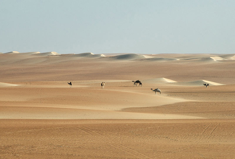
From your camp site please get back to this point.
20°05’28.47″N – 55°19’30.53″E.
Get back on the faint track ahead North. Follow that track on the sabkhahs between the dunes.
20°15’17.07″N – 55°22’54.72″E.
The faint track you are on merges onto a larger track. Keep going on this new track.
20°32’53.82″N – 55°32’32.52″E.
At the Track junction, take left and follow on.
20°38’11.40″N – 55°32’54.71″E.
At the cross section, first take left at the fork, then head straight.
20°39’58.21″N – 55°30’43.35″E.
At the cross section, first keep straight, then at the Y take left. Then stay on this track. You’ll soon pass the first Oil out-post, as more will soon follow.
20°49’02.22″N – 55°27’30.48″E.
At the cross section, keep straight, then left.
20°57’23.68″N – 55°23’43.83″E.
At the T-Junction, keep straight.
20°58’54.84″N – 55°23’48.90″E.
At the junction, Take right.
20°59’51.11″N – 55°30’40.86″E.
At the track junction take left. You are at an oasis with a small barasti where you can find drinks and sometimes basic food stuffs.
21°11’08.61″N – 55°28’49.58″E.
Take left, then right to continue onward.
21°22’53.69″N – 55°28’06.50″E.
The Saudi border is at the foot of that large dune on your left.
21°36’58.24″N – 55°36’22.36″E.
This is the end of the beautiful dune area before a long sabkhah. I advise you to look for camp around here. Don’t look too far off you are still too close to the Saudi border to take chances.
This is the end of day fourteen on the trail.
Day Fifteen
Ar Rub Al Khali to Yanqul
310 km.
Introduction.
After breathtaking dunes, today is a return to reality, where you’ll be transitioning through the flat plains all the way to the edge of the Al Hajar mountains. On the way you’ll pass through the town of Ibri, visit its fort and the ruins of old al Sulaif, before heading to Yanqul where you’ll be able to refill and get food supplies.
Recommendations.
Really nothing particular about today. You can even sleep in for a late morning and take one good look at the beautiful desert you’re about to leave behind. Re-inflate once off the sand back to normal tire pressure.
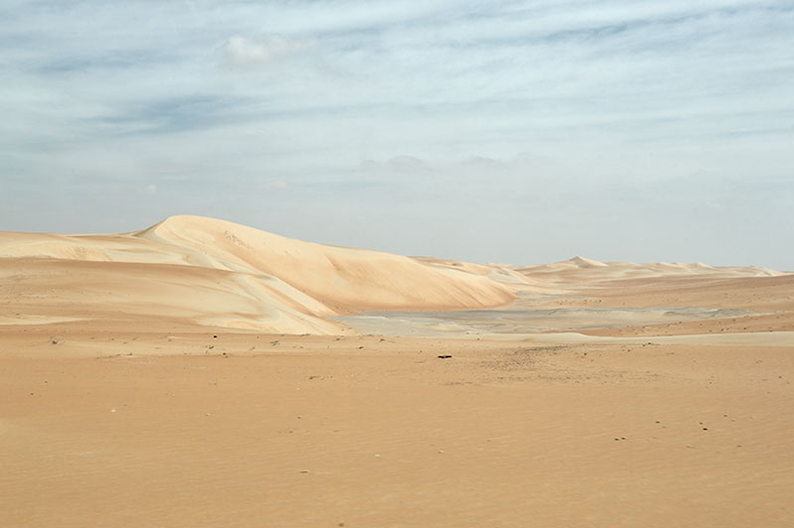
The drive.
21°36’53.64″N – 55°39’05.16″E.
Starting point of this transition day. Head north on this track.
21°53’16.17″N – 55°51’45.43″E.
At the T-Junction turn right.
21°54’44.47″N – 55°57’03.96″E.
At the junction, stay straight on your track as it bends east.
21°54’43.80″N – 55°58’37.54″E.
At the Y-Junction, take left as you drive through your first oil field facility. Stay on this main track as the infrastructures will be on be on your right.
21°57’28.63″N – 56°01’56.67″E.
At the junction, take left heading North. Keep on this road as it passes through your second oil field.
22°09’36.37″N – 56°01’34.57″E.
At the junction, turn left.
22°10’09.02″N – 56°01’23.52″E.
At the junction, take right.
22°10’11.14″N – 56°01’40.00″E.
At the junction, take Left, and head on straight up on that track through the plain.
22°30’05.13″N – 55°59’41.27″E.
At the junction, take left on the road.
22°35’03.05″N – 55°52’20.32″E.
At the round-about, take right. Follow that road all the way to Highway 29 at Ad Dubayshi.
23°09’56.31″N – 56°28’25.87″E.
At the round-about, take left. You’re now all Highway 29 taking you to Highway 21 and Ibri.
23°12’58.37″N – 56°29’26.51″E.
At the round-about, take right. You have reached Ibri and Highway 21. You have a gas station on you’re left as well as plenty of markets in town. You’re back in civilization !!
It be noted, that Yanqul where you’ll camp a bit further on, also has a couple of gas stations a nice market and a restaurant where you can have diner.
While here take the time to stop at the ruins of Al Sulaif and visit the Ibri castle.
23°12’57.81″N – 56°30’55.02″E.
At the round-about, take left on Highway 9. If you are want to visit Al Sulaif keep straight, if you’re coming back from it, take right.
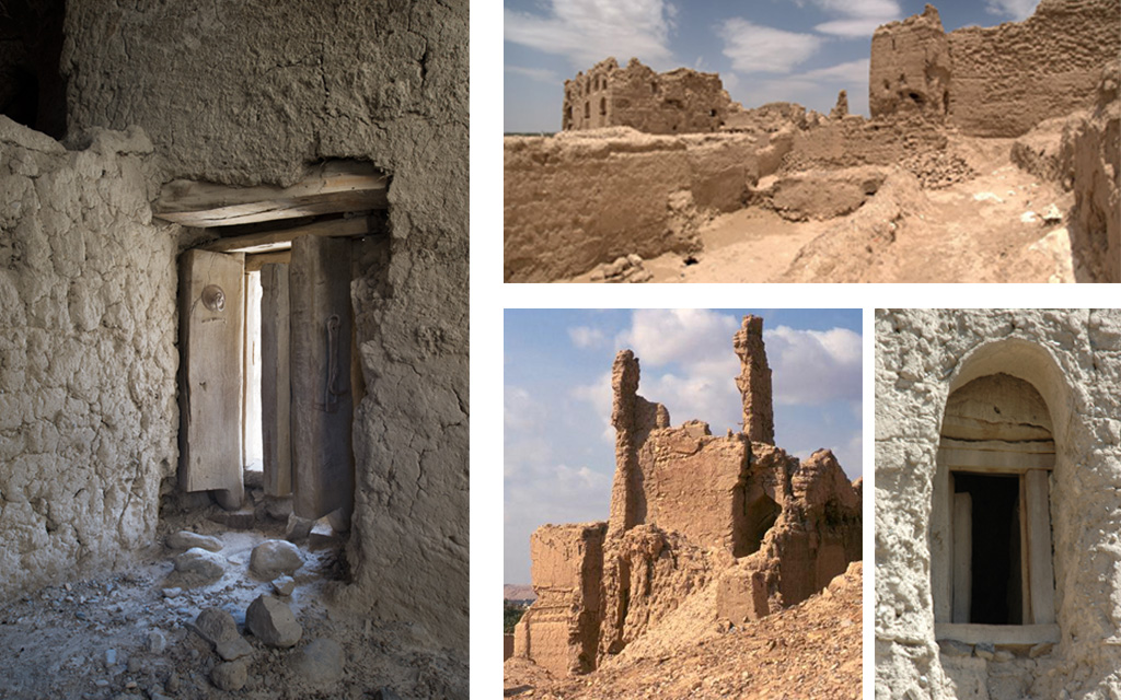
Once on Highway 9, keep going till you reach Highway 8.
23°21’40.38″N – 56°39’27.46″E.
At the round-about, take left on highway 8 towards Yanqul.
23°34’50.55″N – 56°34’13.67″E.
You probably did refill at Ibri, this shell station is a good idea to stop again if you need it in order to be good for the entire day tomorrow.
23°35’25.69″N – 56°32’45.93″E.
As you are now in Yanqul, turn right at the junction. On your left you’ll find a good supermarket and a place to eat before reaching your campsite soon after.
23°36’17.46″N – 56°32’34.71″E.
At the Junction take right on the residential street and follow through as it will turn into a dirt track.
23°37’10.76″N – 56°32’50.12″E.
As the road turns into dirt, take right at the Y-Junction. Keep on going as it passes underneath the road under-construction.
23°38’06.13″N – 56°33’33.56″E.
Leave the main track and head for the small wadi bed where you can find a nice and quiet camp site for the night.
23°37’59.30″N – 56°34’04.30″E.
This is a nice camp option.
This is the end of day fifteen on the trail.
Day Sixteen
Yanqul to Bat
235 km.
Introduction.
We are back in the Al Hajar, exploring this time the Eastern part. On the program today, amazing mountain trails, Wadi Al Surami, the al Aqli ruins, the Al Qirayyah rock and the Maqniyat Aswad fort.
Recommendations.
Back in mountains and rocks, with steep climbs and steep descents. Nothing compare to the Oriental side we started with two weeks ago, but still challenging at times.
Bring your tire pressure down to 20/25 PSI and drive with caution.
The drive.
23°37’59.30″N – 56°34’04.30″E.
From here get back to yesterday’s track. And turn right.
23°38’47.11″N – 56°33’56.10″E.
At the Y-Junction take right.
23°39’04.41″N – 56°34’17.75″E.
At the Y-Junction take right.
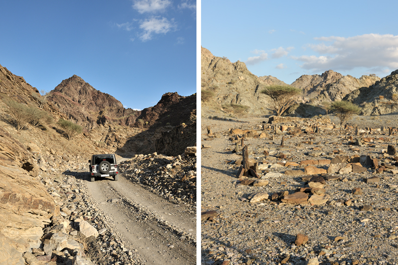
23°39’18.12″N – 56°34’50.63″E.
At the Y-Junction take left and left again.
23°39’38.24″N – 56°34’53.44″E.
At the Y-Junction take right and follow the wadi bed.
23°40’51.47″N – 56°35’36.20″E.
At the Junction take right.
23°40’18.25″N – 56°36’32.67″E.
At the Y-Junction take left.
23°39’57.48″N – 56°36’50.10″E.
At the T-Junction take left.
23°39’58.60″N – 56°37’37.56″E.
At the T-Junction take left.
23°40’06.08″N – 56°38’02.81″E.
At the road take left and follow it through the wadi as it will at one point turn to a dirt track.
23°42’15.70″N – 56°37’02.60″E.
At the junction take right.
23°46’11.82″N – 56°38’19.07″E.
At the T-Junction turn left.
23°46’57.25″N – 56°37’52.42″E.
At the T-Junction turn left and follow the main road.
23°49’09.34″N – 56°36’46.80″E.
At the Y-Junction turn right.
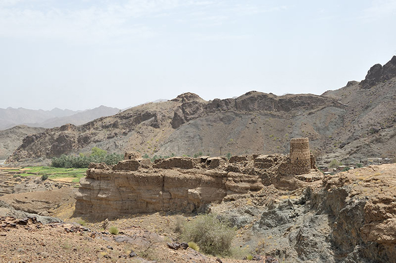
23°49’54.06″N – 56°37’32.34″E.
Keep straight, then stay left and finally take right at the next two junctions. You will see a beautiful ruin on your right and then cross the wadi.
Once up on the other side of the wadi, follow the track as it bends left and follows the wadi bed from above all the way to the village of Shayrah. There you’ll cross the Wadi again and climb back up towards the road.
23°52’04.37″N – 56°38’29.12″E.
At the T-Junction turn right. The road will quickly turn to a dirt track and follow the wadi. Depending on the level of water it can make for a very fun drive.
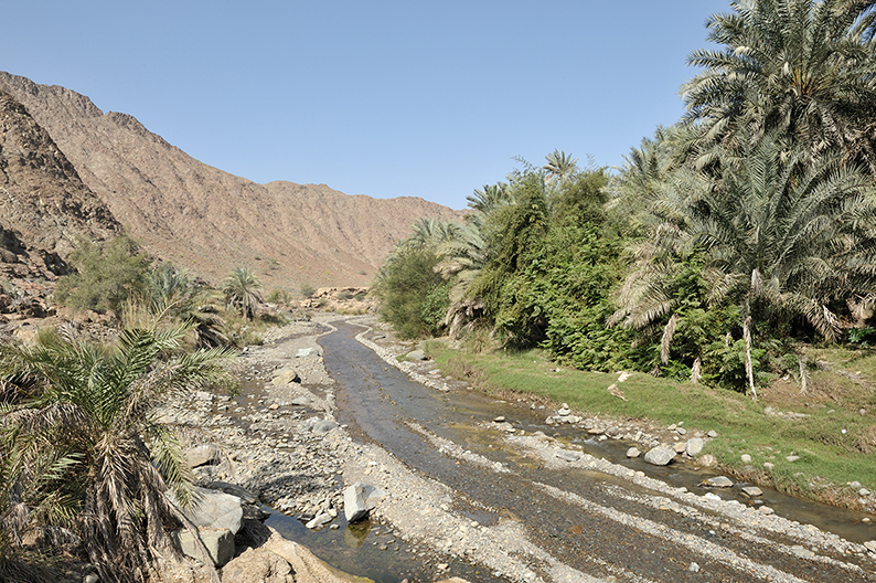
23°55’09.72″N – 56°42’12.84″E.
At the T-Junction keep straight.
23°55’39.05″N – 56°42’53.58″E.
At the Y-Junction take right, and right again at the top.
23°55’08.48″N – 56°44’09.05″E.
As much as crossing that wadi and its water sounds like fun, you need to turn right and head up.
23°53’28.76″N – 56°45’25.72″E.
At the junction take left and keep straight on that track through the next coming cross section.
23°50’57.98″N – 56°47’46.07″E.
As you reach the road, take right. Drive on till you reach the Al Aqli ruins.
23°48’48.98″N – 56°46’21.73″E.
You have reach the Al Aqli ruins. Take right and park to have a walk around the ruins. You can also follow the falaj which is still very active today.
Once done get back on the road and follow through.
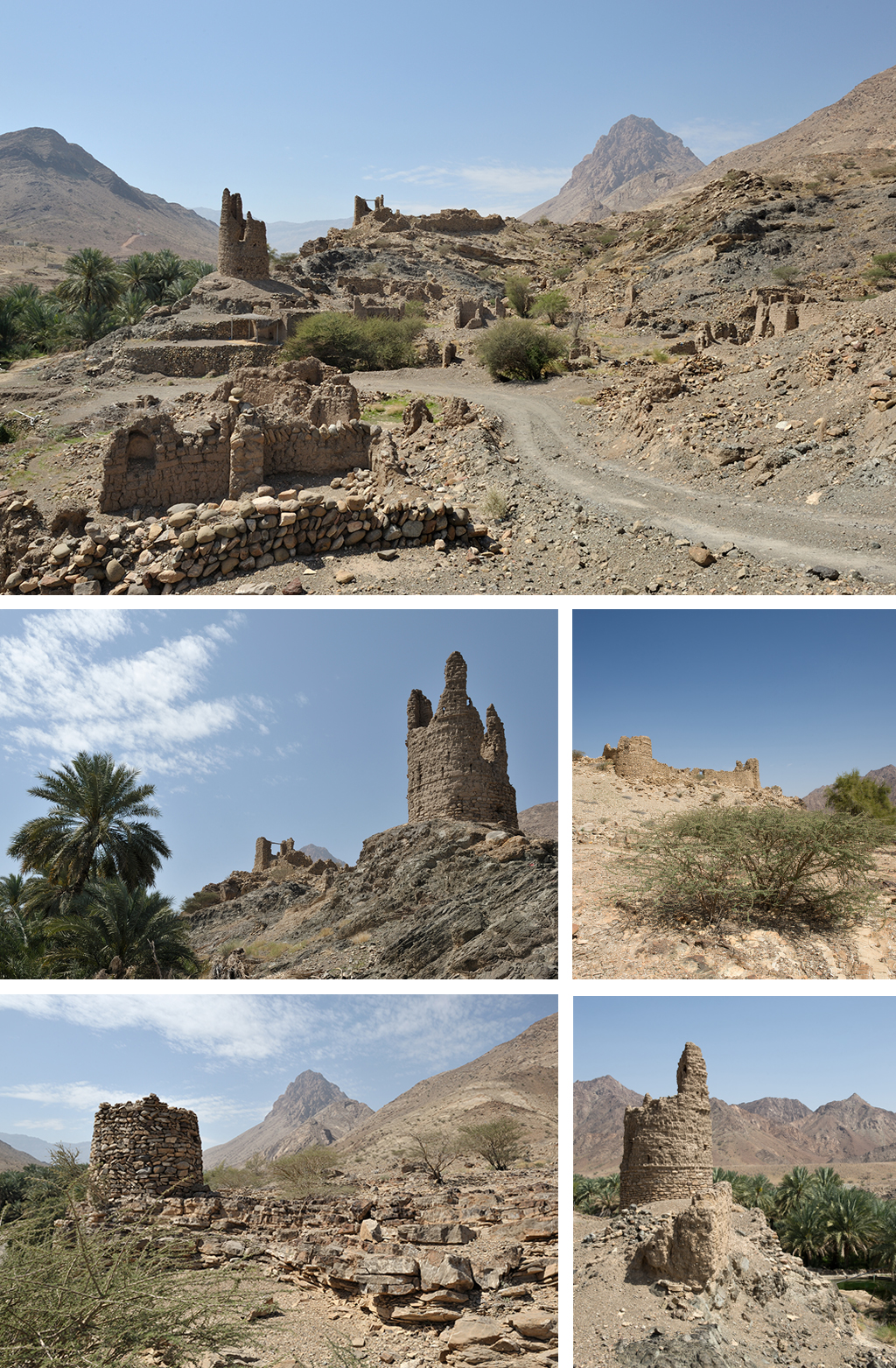
23°47’04.19″N – 56°44’07.41″E.
Leave the road for the track on your left. Get down and cross the wadi and follow through.
23°45’45.36″N – 56°47’14.07″E.
At the T-Junction turn right, then left again as you pass by the village. The tracks climbs up. As it climbs it get worse (at least at the time I passed it) Nothing that should stops you, but it does make driving more interesting. Same thing as you get on the other side. The rain and the fact that not many people use this trail make it necessary to drive with caution.
23°42’50.23″N – 56°45’41.35″E.
At the T-Junction turn left and get back on the road.
23°43’20.26″N – 56°49’11.44″E.
Get on the dirt track climbing up towards the phone antenna. You’re on a beautiful trail taking you through the mountains for a while.
23°39’18.24″N – 56°51’34.69″E.
At the T-Junction turn right, and stay left at the following Y-Junction.
23°37’06.54″N – 56°51’41.24″E.
Keep left.
23°33’56.18″N – 56°53’51.84″E.
You’re back on the road, take left.
23°35’07.35″N – 56°57’52.05″E.
Leave the road and head down the wadi as you follow the track on your right.
23°29’56.60″N – 57°01’09.17″E.
Keep straight on the main road.
23°29’32.60″N – 57°00’38.19″E.
At the Junction take left, and straight on.
23°29’16.01″N – 57°00’34.41″E.
At the T-Junction, turn left.
23°28’48.71″N – 57°01’44.81″E.
At the T-Junction, turn right. What used to be a trail as of just last year is now a road. Follow that road. (Some part are still made of dirt, but not for long!)
23°22’50.80″N – 57°00’50.49″E.
At the T-Junction, turn right. Here is a bit confusing because of the road construction going on at the time. The idea is to get on Highway 10 towards Bid’ah and the Maqniyat fort.
Once on that road just follow through as it follows the wadi.
23°22’30.27″N – 56°53’11.48″E.
On the right you can see the Maqniyat fort. It is a ruin, and as such it is interesting to see and compare with the one that have been restored. The amount of work put in to bring them back to their original splendor. There is no direct access by car. You need to park and walk up to it.
23°23’59.70″N – 56°46’28.74″E.
Gas station.
23°23’55.56″N – 56°44’51.97″E.
Get off the road as you turn left on the dirt track.
23°22’50.80″N – 57°00’50.49″E.
Get off the main track and start looking for a place to spend the night. Do not stay too close from the main track you were on. It is subject to traffic as trucks come back and forth from a quarry a bit further along.
23°20’04.74″N – 56°44’57.62″E.
This is our selected campsite for the night.
This is the end of day sixteen on the trail.
Day Seventeen
Bat to Jabal Shams
95 km.
Introduction.
Short drive today taking you up to Jabal Shams. On the way you will stop to see the Bat and Al Ayn tombs. There you’ll park your car and spend the afternoon climbing up and down the mountain summit or choose to brave the cliffs following the old track on the edge of Wadi Ghul…
Recommendations.
Easy transition drive mostly on roads towards Jabal Shams. The climb up and around the mountain is fun.
Once in Jabal Shams you can either camp out or stay in one of the local resorts. I have always camped, but enjoyed the buffet diner at the Jabal Shams resort a few times and recommend it. They even have Vegan options available.
The drive.
23°22’50.80″N – 57°00’50.49″E.
Back on the main track from where you decided to camp. Keep heading south on that main track.
23°16’56.28″N – 56°45’06.19”E.
At the junction with the road, take right and follow the road.
23°16’21.32″N – 56°43’41.44”E.
At the junction, take right and follow the road.
23°15’58.74″N – 56°44’08.17”E.
At the T-Junction, take left.
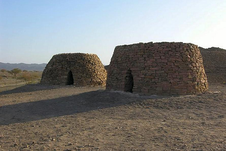
23°15’55.38″N – 56°44’46.87”E.
You have reached the archeological site of the Bat village tombs. Have a look around.
Then keep on that road till the village of Al Ayn for more. They are of the same architecture and historical period as the ones you saw earlier on Jabal Bani Jabir.
23°10’25.88″N – 56°55’05.48”E.
At the T-Junction take left and follow the road.
23°12’21.81″N – 56°57’19.34”E.
Keep left on the main road. Then straight on shortly after at the next T-Junction.
23°12’45.12″N – 56°57’43.07”E.
Get off the road and onto the track on your left. From you need to cross the small wadi and once on the other side find a place to park in order to clim up to the Beehive tombs you can now see at the top of the small hill in front of you.
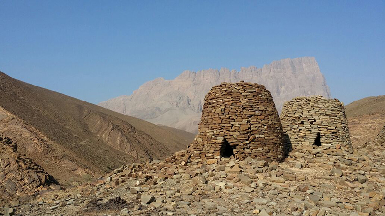
23°12’58.04″N – 56°57’43.51”E.
Al Ayn Beehive tombs.
23°12’45.12″N – 56°57’43.07”E.
Once back on the road, keep in the same original direction until the next round-about and then take the first exit right and climb up.
23°09’46.54″N – 57°04’17.24”E.
Take left on the dirt track right before the buildings.
23°09’41.85″N – 57°05’15.71”E.
Keep straight and start to climb.
23°09’39.48″N – 57°05’42.80”E.
Stay right on the main track. Both here, and at the following junction that leads to the hamlet.
23°10’24.33″N – 57°08’56.81”E.
Take left on the road leading now to Jabal Shams. Stay on that road all the way up.
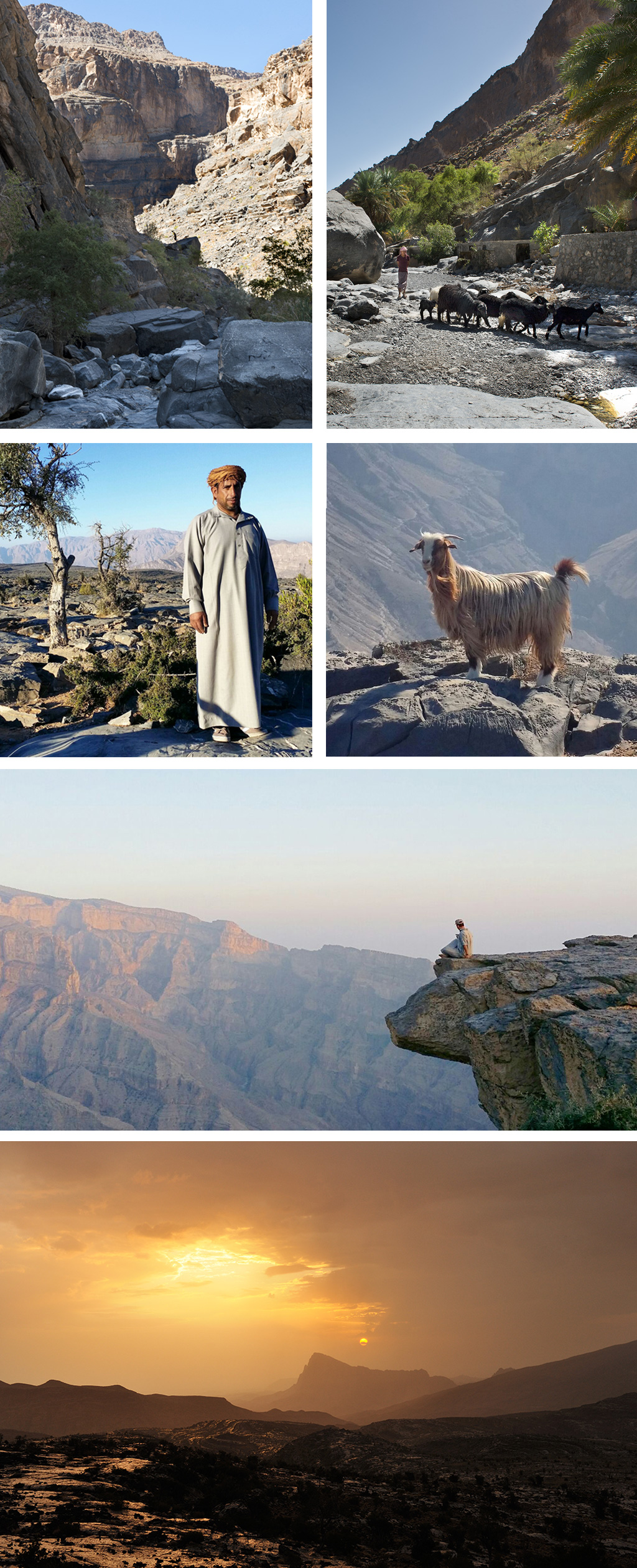
23°15’08.50″N – 57°10’00.44”E.
At the Y-Junction take left, and stay right at the following right after.
23°16’52.82″N – 57°09’45.00”E.
Take right.
23°14’46.84″N – 57°13’04.74”E.
Keep straight.
23°14’22.28″N – 57°11’51.78”E.
Take left.
23°13’35.28″N – 57°12’04.30”E.
This is the hotel where you can have diner tonight. It’s quite good. You can even decide to sleep there if you want. There is a second option down the road but I have not tried it. It is also the start of the W4 trail that can take you to the Jabal Shams summit.
If you want to tackle trail W6 down wadi Ghul, keep driving down this road all the way till its dead-end and park there.
Campsite
There are so many options for you all around. But taking the cliff option by the edge of the canyon is popular and can be crowded, particularly on week-ends. Here is a quieter option if that was the case:
23°13’15.84″N – 57°12’05.74”E.
Leave the road and take right on the trail passing in front of the small house. Keep going pass the flat ground and drive around the hill. Once on the other side leave the track and get down through the flat rocks to find your campsite. It’s just one among the many many options around. But this one is quiet, which might not be the case on the other side, particularly on week-ends.
23°13’14.46″N – 57°11’23.76”E.
Recommended campsite.
This is the end of day seventeen on the trail.
Day Eighteen
Jabal Shams to Jabal Akhdar
191 km.
Introduction.
Today is a culture day. The Ghul ruins, Al Hamra, Misfat al Abriyyin, the Hoota cave, the Balah Fort, The Jabrin Castle, Nizwa fort and souk… So much to see, so little time !
Recommendations.
Apart from the early part of the drive coming down from Jabal Shams and the climb back up to Jabal Akhdar, today is spent driving around on roads from one culture site to the next. Keep your tires at their normal pressure.
The drive.
23°13’15.84″N – 57°12’05.74”E.
Once you are back on the road, at 23°14’22.28″N – 57°11’51.78”E. Take left and drive back down from Jabal Shams, and keep on that road all the way to the town of Al Hamra.
23°08’56.46″N – 57°12’14.01”E.
Leave the road, get down across the wadi and park your car and the entrance of
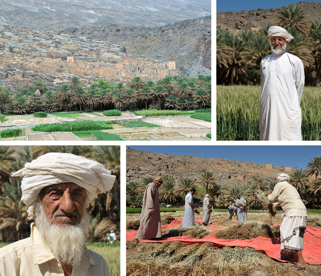
Back on the road, resume your journey towards Al Hamra.
23°06’59.72″N – 57°16’49.76”E.
Leave the road, take left going down toward the wadi bed.-, cross it and turn left as you reach the tarmac again. At the round-about take the first exit right.
23°06’05.08″N – 57°16’46.91”E.
Turn left and enter the palm garden.
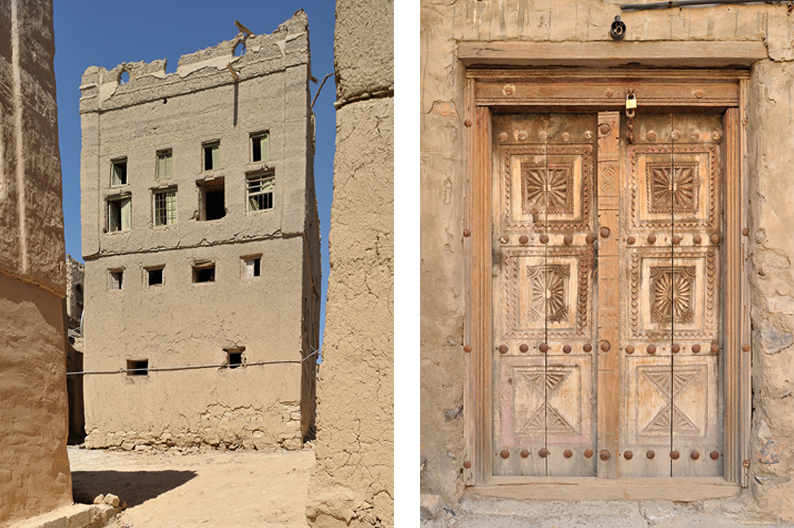
23°07’12.94″N – 57°16’51.29”E.
You’ve entered the old Al Hamra. Turn right. Park your car and have a look around.
Once done, head straight that street until you exit the old town.
23°07’12.92″N – 57°17’07.90”E.
As you exit the old town keep straight heading west.
23°07’12.58″N – 57°17’16.10”E.
At the fork follow right as the road bends south-southeast.
23°07’07.84″N – 57°17’20.30”E.
At the Fork stay on the left.
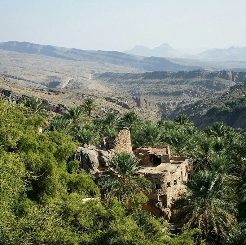
23°07’12.92″N – 57°17’07.90”E.
Turn left and drive all the way up to Misfat Al Abriyyin. Have a tour, then drive back to this point. You will then turn left ad follow this road on till the round-about where you will turn right.
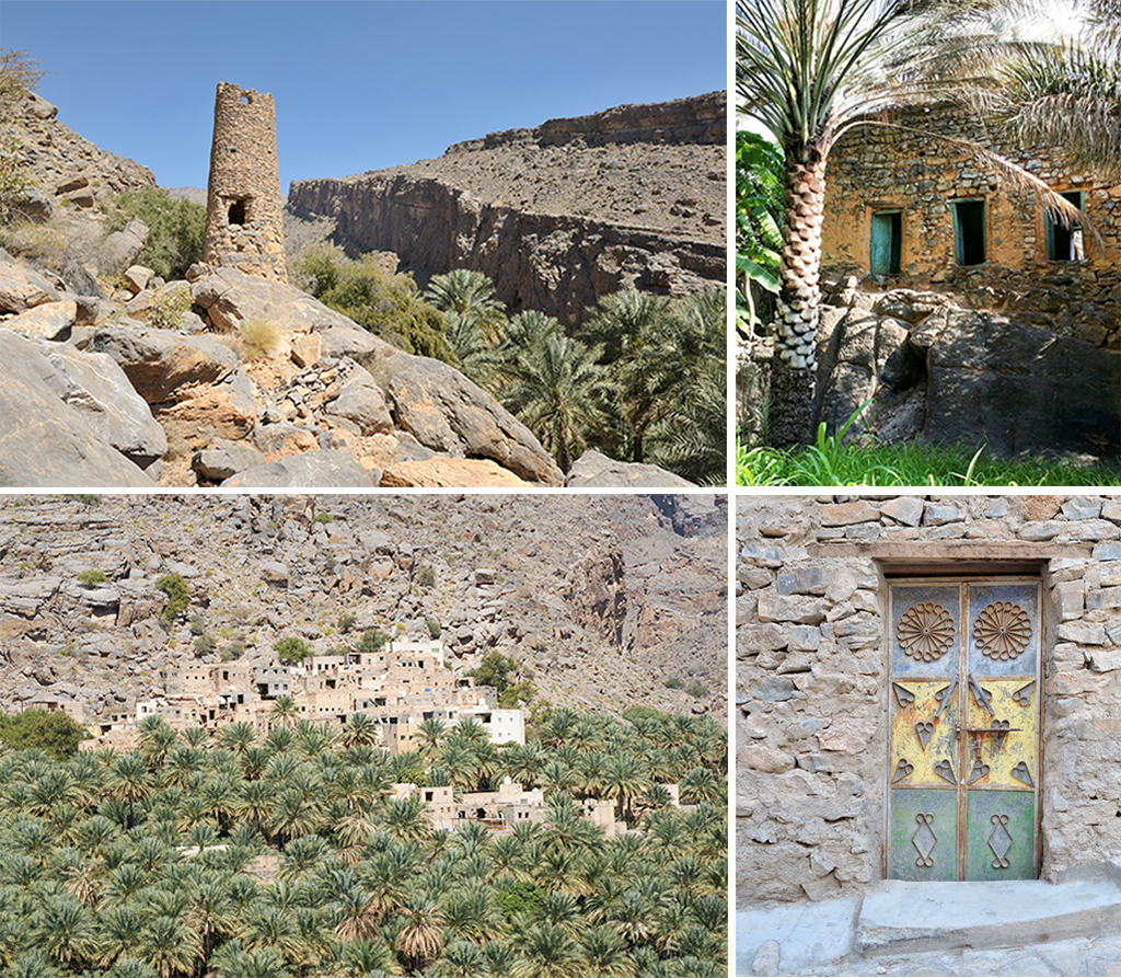
23°06’40.37″N – 57°17’31.02”E.
Turn left and drive on all the way to the Al Hoota cave. Have a visit, then drive back to this point where you’ll turn left and drive on, pass the first round-about straight.
Al Hoota Cave
A 2 million year old underground cave at the bottom of the mountains. Its underground lake which grew so big a few years back they had to close the cave. It’s now back to “normal” and the water is divided in four small water reservoirs in the back of the cave, and the main lake. You can visit about 500 meters of the 4.5 kms of the cave. It’s a bit small but yet very impressive. The second main attraction is its “Lion”, a large stone formation clearly looking like a lion’s head overlooking the visitors as they go through the lighted path.
For all necessary infos on the cave visit its website.
23°06’02.70″N – 57°16’39.00”E.
At the round-about keep straight on. Be noted you have on the right a gas station, supermarket and a restaurant if you need.
From here you are heading for the town of Bahla and its beautiful fort. Just follow the signs.
The Bahla Fort.
22°57’52.00″N – 57°18’02.05”E.
To quote Wikipedia, The fort “is one of four historic fortresses situated at the foot of the Djebel Akhdar highlands in Oman. It was built in the 13th and 14th centuries, when the Oasis of Bahla was prosperous under the control of the Banu Nebhan tribe. The fort’s ruined adobe walls and towers rise some 165 feet above its sandstone foundations. Nearby to the southwest is the Friday Mosque with a 14th-century sculpted mihrab.”
Don’t be afraid of bats, as they seek the shade and cool temperatures provided by the interior rooms during the day. (You shouldn’t be afraid of bats regardless, and try not to disturb them as they rest waiting for the night).
Open until 4pm 2 rials fee.
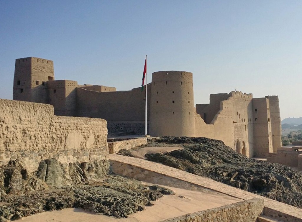
From here get back on the main road and follow the signs guiding you to your next cultural visit, the Jabrin Castle on the other side of Highway 15.
The Jabrin Castle.
22°54’55.06″N – 57°14’56.72”E.
The castle is the local version of a renaissance. Compared to the Balah fort you just visited, Jabrin is more ornate, more decorated, in an attempt to bring comfort and refinements to the place and move away from the spartan architecture of other forts in Oman. It was also intended to be a cultural center, with scholars from various fields such as law and medicine holding sessions. Check out the painted ceilings and ornate latticed windows.
(Open every day from 8am to 5PM – free)
From here go back to Highway 15, and follow the Nizwa sign. Get off at the Nizwa exit after the large Mosque on your right. Pass over the freeway and head towards the center of town and its fort. Shortly after the exit is a large mall. A good place to get food, The pizza place in the food court is a good choice.
If not keep driving all the way to the fort and its souk.
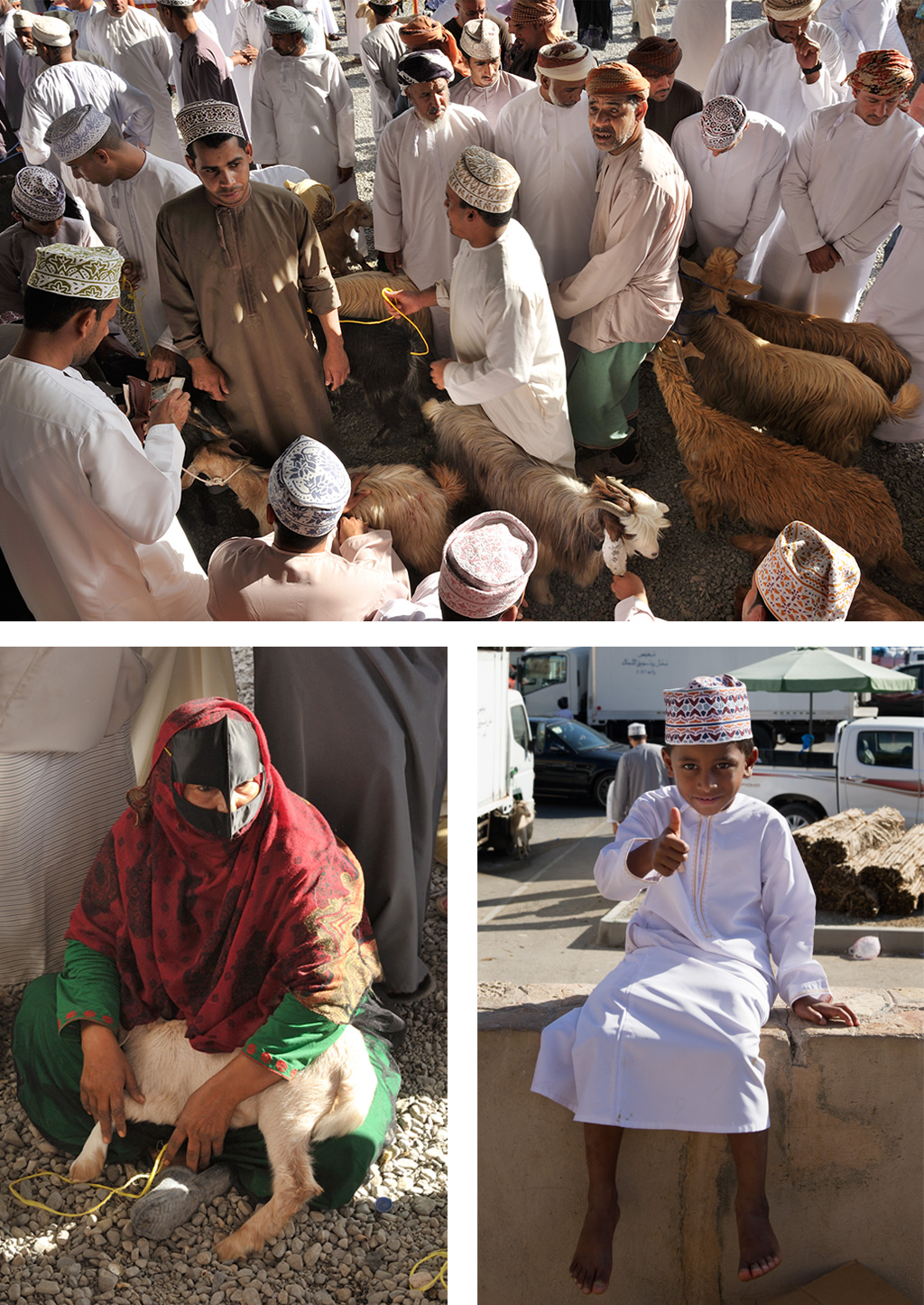
Nizwa.
22°55’59.36″N – 57°31’48.87”E.
Nizwa is a very popular destination, and its fort is one of the rare landmark having a decent wikipedia page describing it. Instead of copying it here, I invite you to check it out to learn more about the fort.
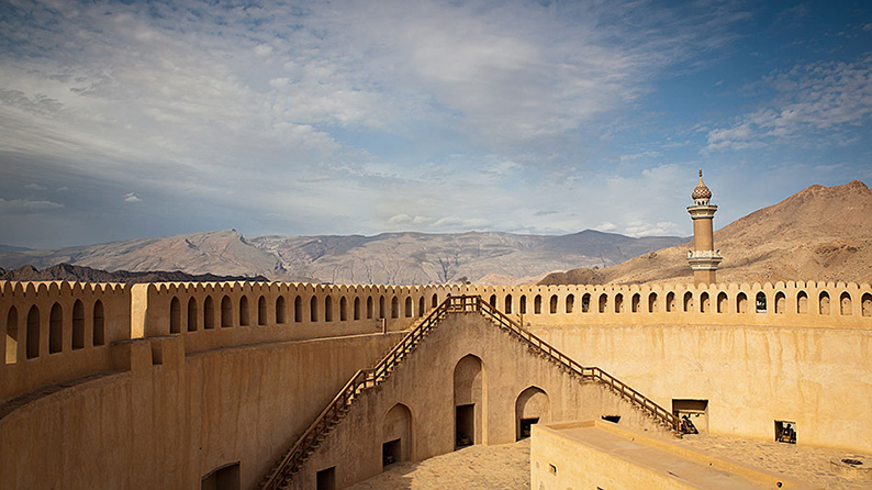
From here get back on Highway 21 heading back towards Al Hamra.
22°57’37.79″N – 57°31’46.55”E.
Refill here if you haven’t already, this is one of your last chances before a long while.
23°01’53.38″N – 57°25’18.06”E.
Turn left here. You have a gas station if needed. This is the last one before climbing back to the mountains.
Head straight towards the foot of the mountain. You can see a trail climbing up, this is where you want to go.
23°03’36.32″N – 57°26’06.07”E.
Turn left here, and follow the road as it turns into a dirt track climbing up.
23°05’35.31″N – 57°25’59.53”E.
Take left towards the village.
23°05’36.94″N – 57°25’48.34”E.
Take right between the buildings and climb straight up that little steep stretch. From here follow the main track until the road.
23°06’29.88″N – 57°24’35.56”E.
Take right on the road and climb up all the way.
23°10’01.71″N – 57°24’54.82”E.
This is the end of the day. Enjoy the view of what is to come tomorrow. On your left is a hotel. It’s good place to have diner. You can stay the night as well. Or you can camp on the edge of the cliff. Don’t stay to close to the hotel if you do just to be in a quieter spot. It be noted that on week-ends the place is “popular”.
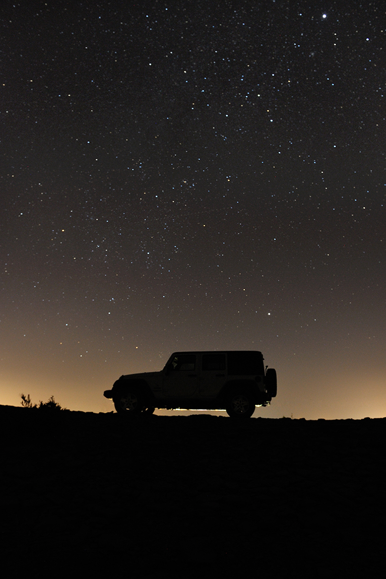
This is the end of day eigteen on the trail.
Day Nineteen
Jabal Akhdar to Muscat
213 km.
Introduction.
Our last day, returning to our starting point, Muscat, completing our 4.000 kms loop around Oman. And as it should the drive is taking you off-road through beautiful landscapes and villages across the mountains, before stopping at the Nakhl and Najal forts. You can also take the time to go canyoning in Wadi Awf. Enjoy !
Recommendations.
We are back on trails today, starting with a very steep descent towards the village of Bilat Sayt and Wadi Awf, then serpent through the wadii and mountain passes. Have you tire at 20/25 PSI
The drive.
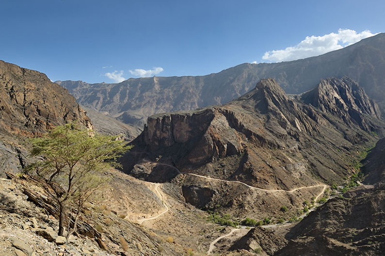
23°10’01.71″N – 57°24’54.82”E.
From where you camped, get back to the parking at the end of the tarmac and head down the dirt track. It’s very steep and can be impressive, just drive with caution. Keep on that main track all the way down.
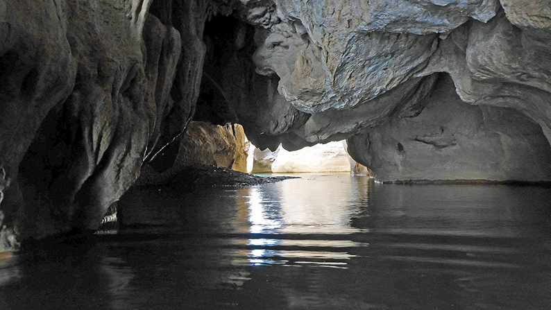
23°11’51.94″N – 57°23’25.82”E.
On your right is wadi Awf, one of the best canyoning spot in Oman. If you want to spend an extra day in the area and explore the canyon, and have the necessary gears for it, you should, it’s definitely worth the exploration.
23°12’05.65″N – 57°23’30.06”E.
The Audi stadium. Build by Audi for one of its commercials.
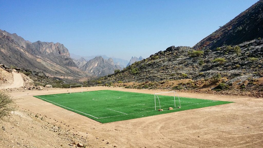
23°12’15.05″N – 57°23’29.77”E.
At the junction take left and drive to the village of Bilat Sayt for a visit. Then come back to this point and keep on this track.
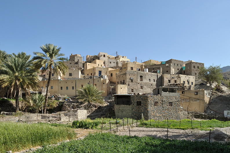
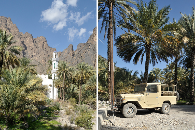
23°12’44.18″N – 57°23’11.84”E.
At the junction take left and drive up.
23°12’58.61″N – 57°23’20.36”E.
Keep straight on up.
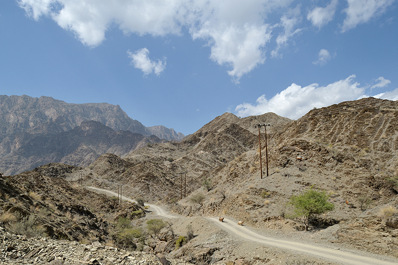
23°13’07.94″N – 57°22’46.35”E.
Keep on the main track as it bends right.
23°13’20.84″N – 57°22’54.49”E.
Take left at the junction, and left again at the next one.
23°14’37.26″N – 57°22’08.67”E.
At the Junction take right.
23°15’19.63″N – 57°23’28.57”E.
Keep straight until the fork where you’ll turn right.
23°15’22.94″N – 57°25’46.59”E.
On your right is Little snake canyon. Take right and park your car further along. From there have a walk through the rocks and pools. (if you have already done wadi Awf, this is a smaller version)
Once done, get back on the main track and carry on.
23°15’30.13″N – 57°26’23.83”E.
At the fork, take right.
23°14’26.37″N – 57°26’15.21”E.
Keep straight. (On your right is the other end of the Little snake canyon)
23°13’51.82″N – 57°25’30.80”E.
At the T-Junction turn left.
23°12’49.33″N – 57°27’23.68”E.
Take left and climb up. It’s steep.
23°12’44.45″N – 57°29’12.52”E.
Keep straight on down.
23°12’53.78″N – 57°30’33.75”E.
Take left on the road.
23°18’03.84″N – 57°31’47.51”E.
Turn left.
23°18’41.94″N – 57°31’17.11”E.
Turn right. You’re now on Highway 13. Follow that road all the way down to the town of Nakhl.
23°24’28.18″N – 57°49’14.73”E.
At the round about, take the first exit right towards the Nakhl fort and follow the signs.
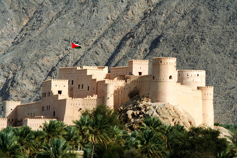
Nakhl Fort.
23°23’40.50″N – 57°49’42.50”E.
Again, one of the newly restored forts in the area, visited not so long ago by Prince Charles. As for Nizwa, I invite you to consult the wiki historical description for more info on what you are about to see.
Once done with your visit back track to the round about and take right on Highway 13 towards Muscat.
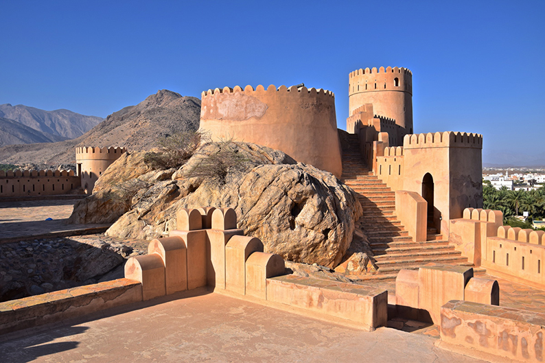
23°30’34.38″N – 57°51’06.76”E.
Turn right and follow that road.
23°31’19.76″N – 57°54’43.85”E.
At the round about take the first exit right and drive up towards the Al Najal fort you can see on the hill. Unlike the Nakhl fort you just visited, this one is still in ruins. It shows you the extend of renovation work between the two.
Once done looking at it, get back to the round about and take the first exit on your right and follow the road.
23°33’27.57″N – 57°59’08.89”E.
At the round-about take right and follow the road. The road is new, one more trail covered in Tarmac.
23°29’40.89″N – 58°02’17.79”E.
Turn left.
23°28’30.35″N – 58°05’40.62”E.
At the T-Junction turn right. Pass the village until you reach the Fanja fort.
23°27’28.27″N – 58°06’06.91”E.
The Fanja fort, best known for its canons.
After the visit, get back on the road in the same direction.
23°27’18.90″N – 58°06’28.65”E.
Take right and follow that road.
23°25’57.33″N – 58°07’11.80”E.
Cross over the Highway. On the other side take the first exit at the round-about, then the first road on your left. Follow it as it bends right and crosses the village.
23°25’14.11″N – 58°08’05.26”E.
Turn right.
23°24’56.89″N – 58°08’04.12”E.
At the fork take right and follow that main street.
23°24’34.68″N – 58°07’58.32”E.
Turn Left.
23°24’21.80″N – 58°08’20.36”E.
Keep straight and cross the wadi.
23°24’22.72″N – 58°08’32.71”E.
As you leave the palm garden take left on the paved road and follow through as it crosses the hamlet.
23°24’39.37″N – 58°08’48.77”E.
Turn right onto the dirt track. This is your last trail of the trip. Enjoy !
23°24’01.84″N – 58°10’10.15”E.
Keep straight.
23°26’10.69″N – 58°12’06.00”E.
Take left.
23°27’15.93″N – 58°12’22.39”E.
Take right.
23°27’02.15″N – 58°13’02.35”E.
Take left on the road.
23°27’27.27″N – 58°13’38.08”E.
Take right.
23°27’37.74″N – 58°13’55.10”E.
Take Left and keep straight all the way till the highway.
23°28’40.56″N – 58°13’41.53”E.
Take right and follow that road all the way to Muscat for the end of this trip.
CONCLUSION
This is the end of our extensive tour of Oman. You are now back in Muscat where you can finish your visit of the town if you didn’t have time on your first day.
I hope this trip will be as rewarding for you as it was for us, and that you’ll go back home full of questions on earth’s origins or the fascinating but tumultuous history of this country.
Now Oman is in an ongoing process of modernization and roads keep popping up everywhere. Do not wait too long to venture out as trails tend to disappear each time I go back.
Make sure to leave your comments and feedback as we need your updates to keep this road book accurate, interesting and safe.
Happy Adventuring !
Fantastic. We are heading here in 2 weeks for 2 weeks. This photo journal is inspiring
Thank you. Have a great trip.
Again, just like the Hajar trail, those images make me want to learn how to drive a 4×4 and go drive around Oman. Thank you for sharing
You’re welcome, read my tutorials and you’ll be all set for a 4×4 adventure. Happy travels.